|
|
|
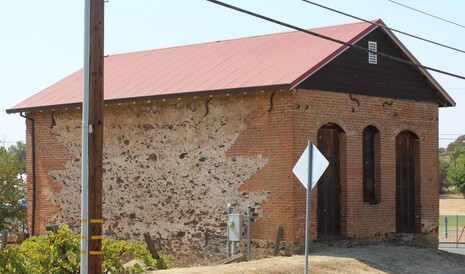
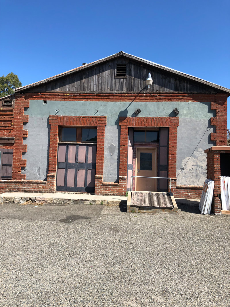
For some inexcusable reason I had never visited Sonora in Tuolumne County until a couple of years ago. We live north of Sonora, so trips to the Gold Country usually involved going to Jackson, Placerville, Auburn or even Grass Valley/Nevada City. Sonora was just a little too far away when we could more easily make it to these other towns. AND the highway to Yosemite turns just a little too soon for us to make a stop in Sonora. What a bummer that turned out to be, Sonora is a really fun town with some great buildings, including some found in the Division of Mine's Bulletin 141 building survey. This included a house found just off of the main drag at what was listed as 905 Shepard Street in the publication, but today is 45 South Shephard45 S Shepherd St 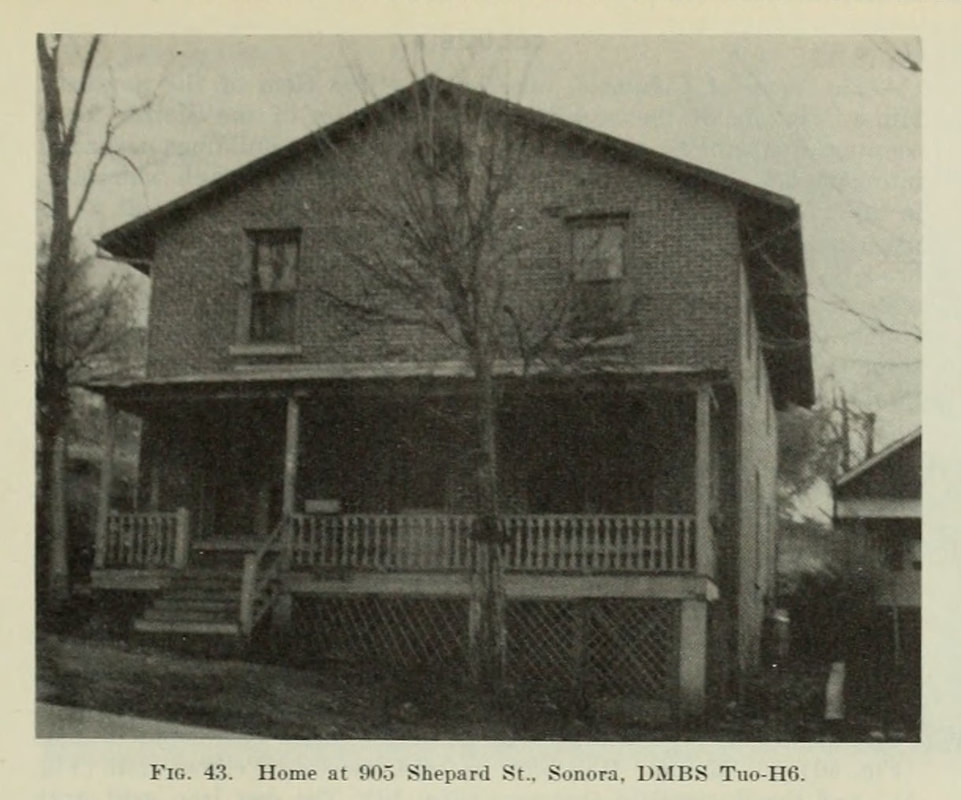 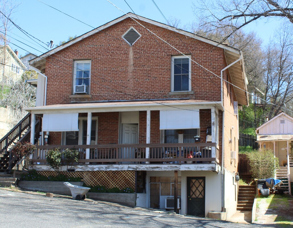 Doing a little research on this building has lead me to some confusion. The bulletin is supposed to include buildings and structures constructed in the Gold Country between 1850 and 1870, buildings erected during the Gold Rush but still standing nearly 100 years later. This house though may not have qualified by those criteria. Fortunately Sonora was a large enough town for the Sanborn fire insurance people to complete a map showing detail about properties in the town. From what I can tell the house doesn't appear on the 1908 map. It should be at the end of the Bradford Street where it runs into Shephard, but the buildings at that spot are not made of brick, nor do they sit at the correct location. The authors of the survey don't give many clues in figuring this out. They merely say that it is "a two story brick building resting on a foundation of schist slabs". I guess that explains why they included it (brick and stone in one building!) but it doesn't clear up the age. And I'll have to take their word on the schist slab because (1) I didn't check out the foundation, and (2) I don't know what schist looks like. I guess it looks like another trip to Sonora is in store.
0 Comments
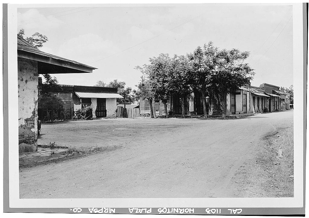
Sacramento has been a great home base for this exploration of Highway 49. From our house it takes roughly an hour driving east to get to the highway. Once there I've got buildings and structures to find heading both the north and south. At the northern end of the study is Downieville in Sierra County (we'll get there soon), but to the south is the site I've most wanted to explore. This town has quite a few still standing buildings, a quarry right in its middle that was used to construct some of the stone structures, and a remoteness from society that has drawn me in. This charming town did not disappoint. Best of all, Hornitos in Mariposa County far exceeded my anticipation. We started with a trip to the center of town, the Plaza. 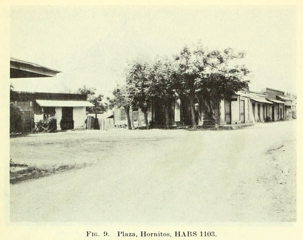 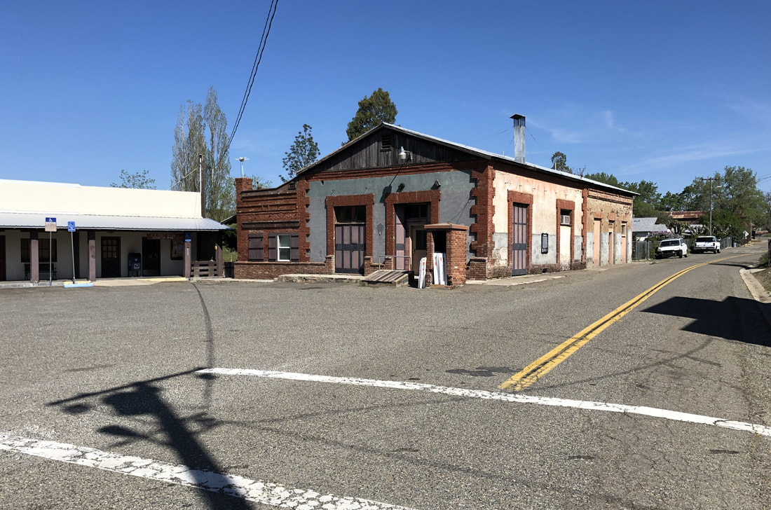 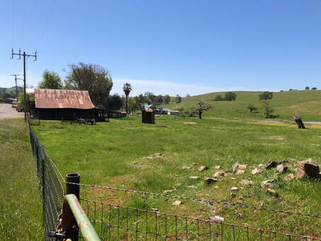 Spring in Hornitos, 2023 Spring in Hornitos, 2023 Hornitos was one of the early mining towns of the southern mines. Taking its name from the Spanish word "little ovens", Hornitos was settled by Mexican miners who had been run out of a nearby mining town. The town had a reputation for rowdiness and if you want to learn more that, visit the town's last bar and chat up the owner for some real stories. The bar is just a few doors down from the well-preserved plaza building shown above.
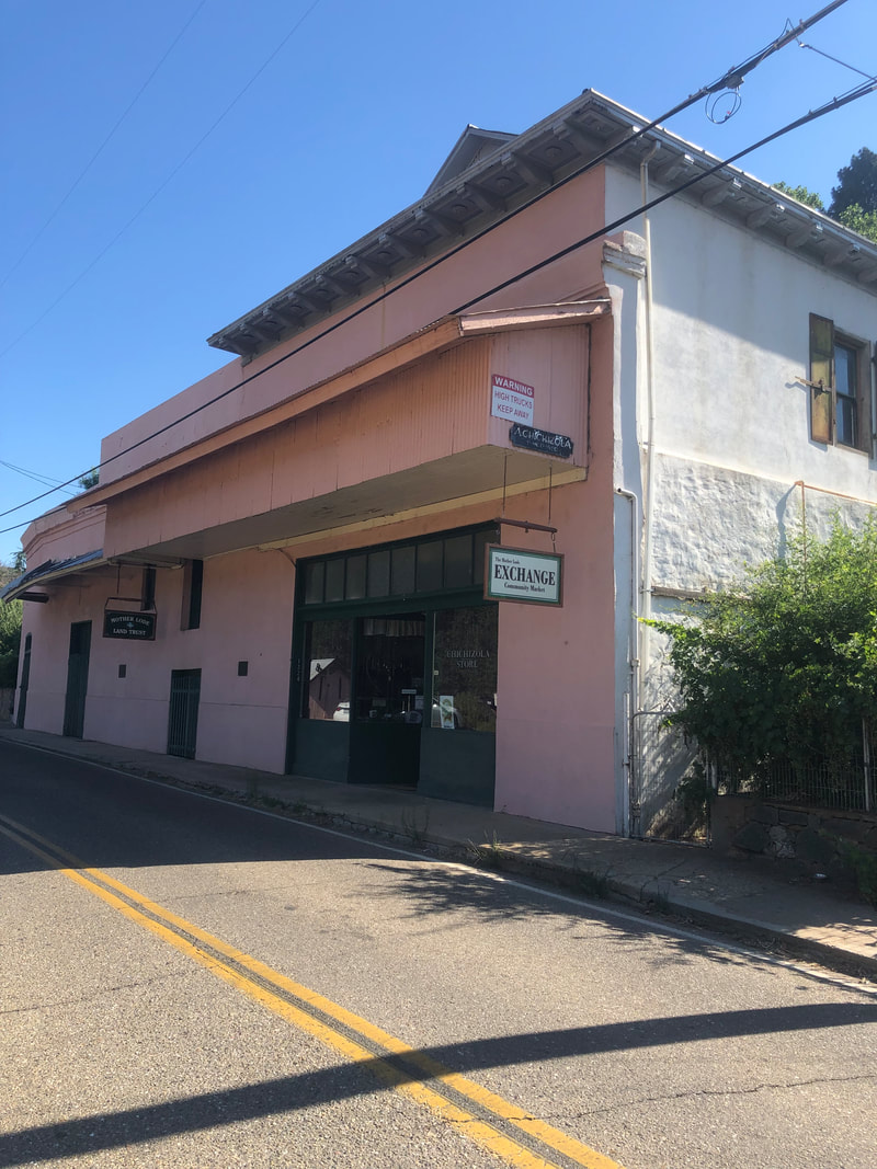
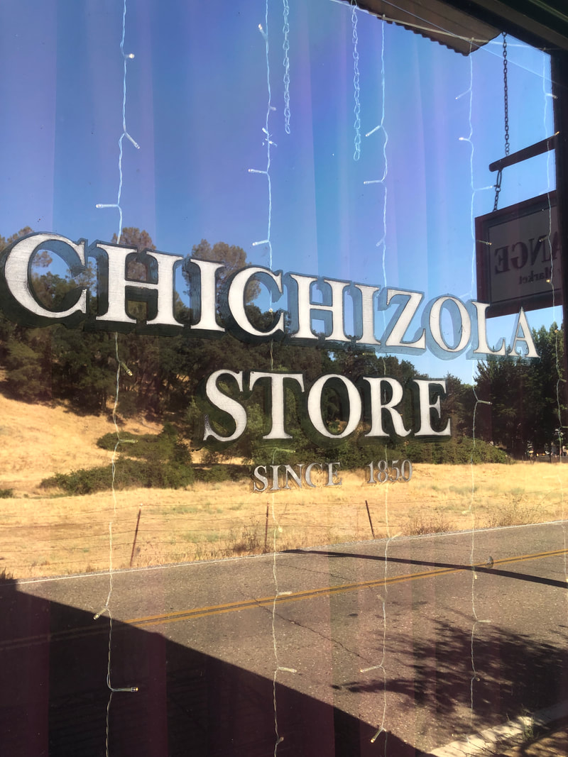
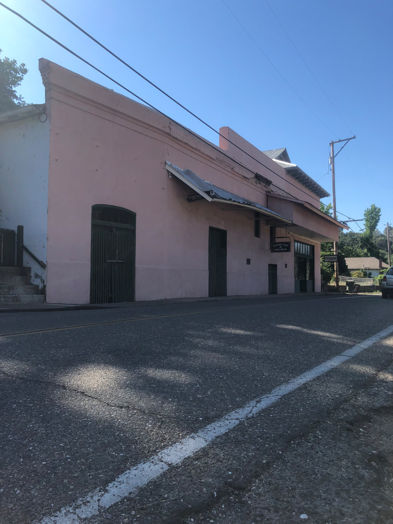
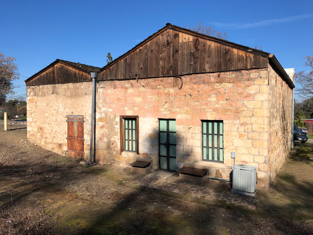
  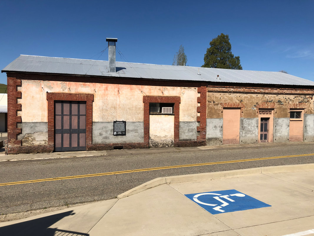 The authors of 1948 Division of Mine's Bulletin 141, the building survey that my repeat photography project is based on, really thought that they were all that. And they actually were, when it came to archeology. Robert Heizer, was one of the authors, for example was the long time head of the anthropology department at UC Berkeley. They however seemed to have skipped the actual research on some these building. For example, the Romaggi Fandango Hall was never a dance hall. And the building that they identified as the Chichizola Store in Jackson Gate, Amador County, is actually located about 500 feet south of the actual Chichizola Store building. 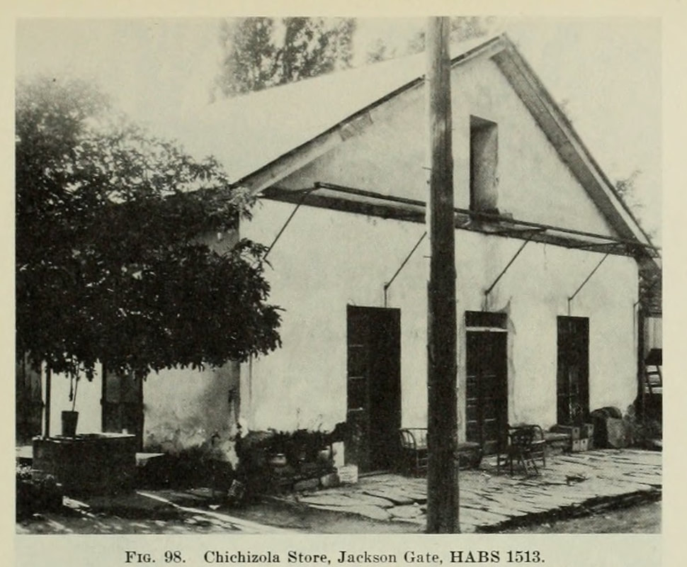 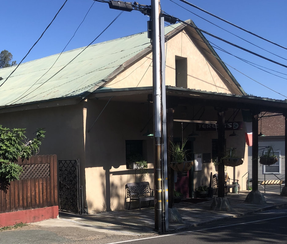  The building in the photograph above today is a family-run Italian restaurant, Teresa's Place. They have been a going concern for over 100 years, although when the earlier photo was taken, their business was as a boarding house for miners. The spectacular Kennedy Mine is just down the road from them. While looking at the building, one of the owners saw me and told me I should go in backdoor to see the inside of the restaurant. Unfortunately when I got cold feet when I poked my nose in and saw no one. The simmering minestrone though was inviting enough on its own. After photographing the building and looking at the menu, it is now on my short list of places to eat. Too bad it's over an hour away from the home base. 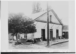 Original HABS photograph identifying the "Chichizola Store" (HABS 1513) Original HABS photograph identifying the "Chichizola Store" (HABS 1513) The confusion about the Chichizola building is somewhat understandable. In the 1930s, the federal HABS project misidentified the building. They interviewed the grandson of the founder of the Chichizola store and collected detail about the building. They then mixed up their research with the HABS photograph. Heizer and his team used this research 10 years later when competing their project. The actual Chichizola store is is still standing and would have been an appropriate addition to Bulletin 141 if they had chosen to include it. Site Visit: May 30, 2022In the 1990s, I worked for a year in Auburn, Placer County. I lived in Sacramento so when I was done with work, I would immediately head down the hill to home. I regret now how much I missed out on. The old town area of Auburn is so charming. Neat little restaurants, bars and shops. Tons of brick and stone buildings, many dating from the 1850s. Sitting at the corner of Sacramento Street and Lincoln Way is the historic Union Bar. And what is really neat is the curved front of the building that hugs the corner of the street. 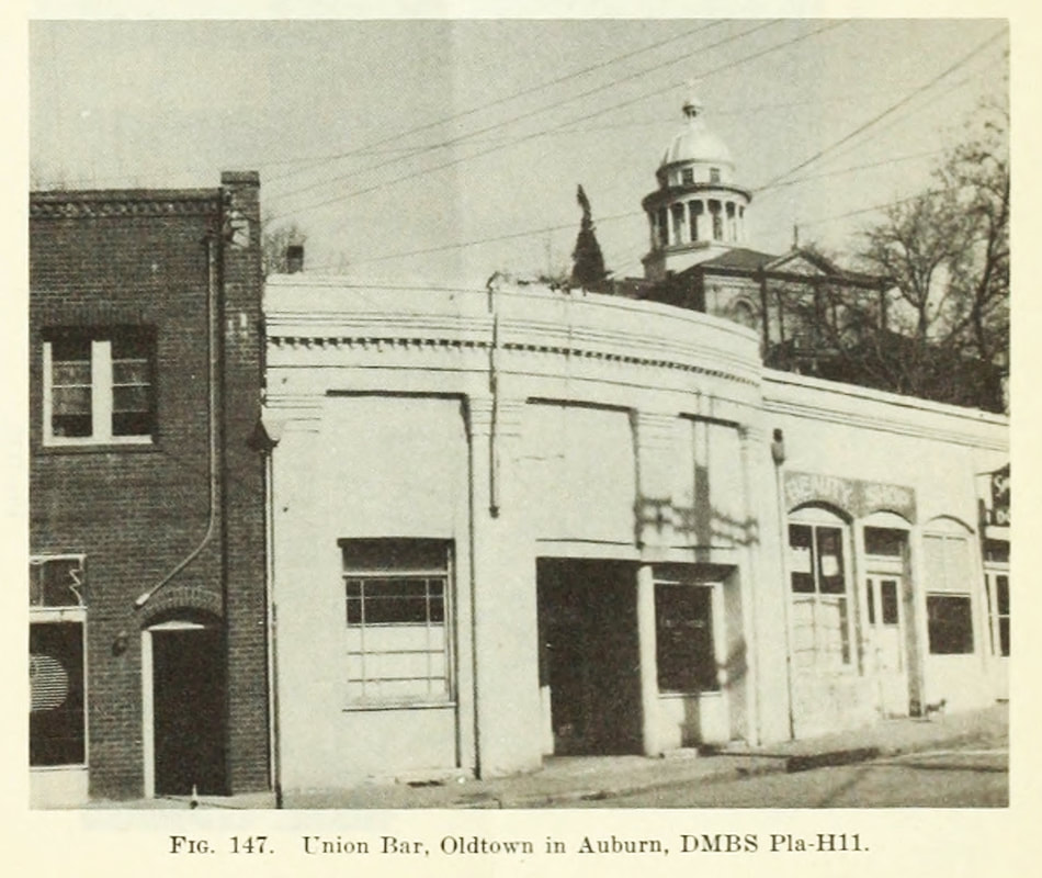 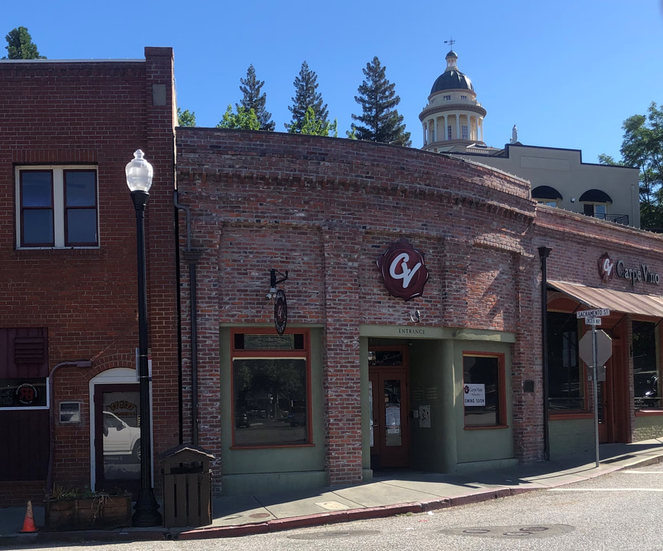 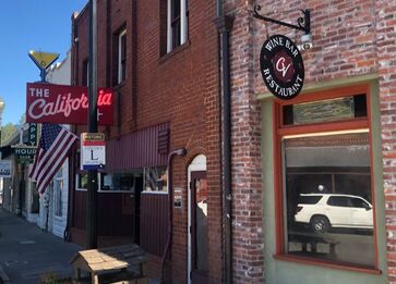 I love that for nearly 170 years you have been able stop and have a drink here. It looks like the drinks though are now pretty expensive, since it is now the fine dining restaurant Carpe Vino. Fortunately you can still get a cheap drink next door at the California. It's got to be a great spot. They had people coming through the door at 9:00 on a Monday morning when I was taking this photo. 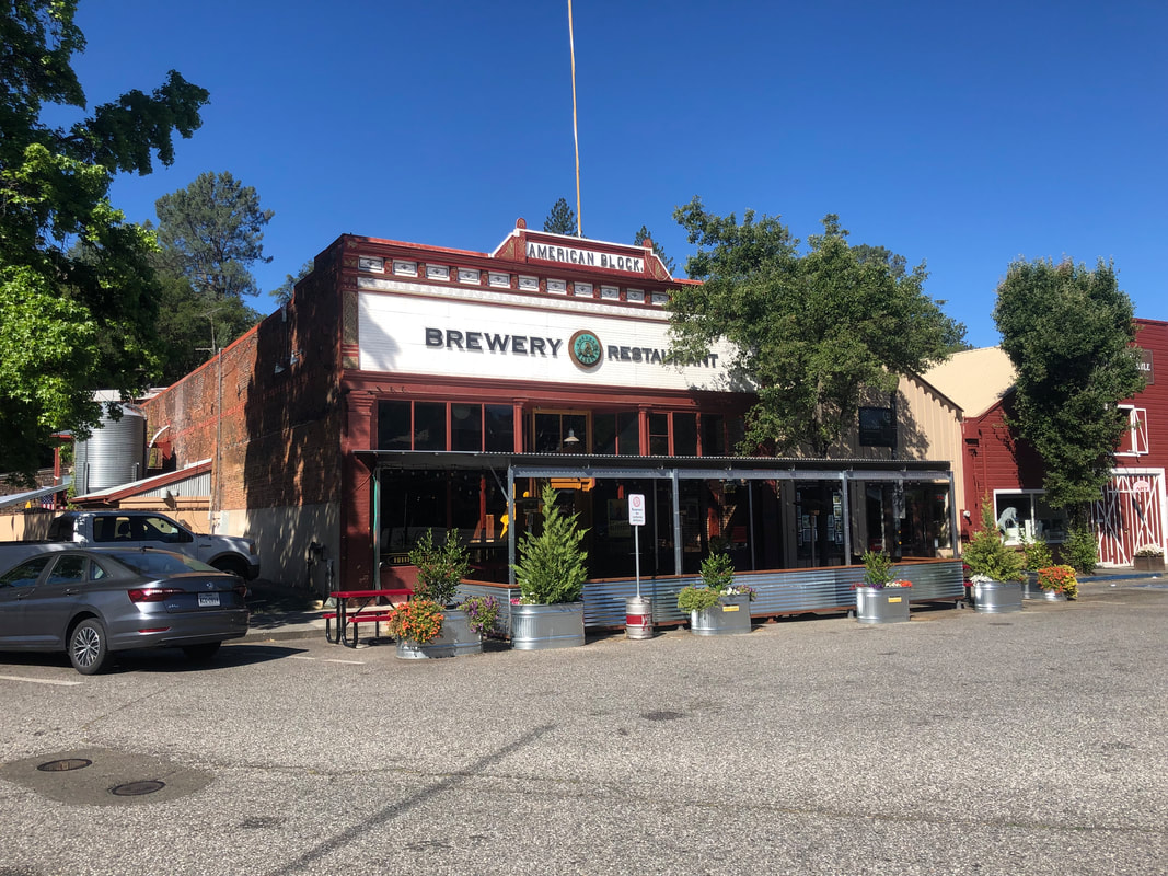 If I was looking for a drink, I probably would have waited and gone across the street to this excellent place. Visit Date: March 31, 2021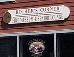 I wish all of the buildings from the 1948 survey were still around. Unfortunately, time has won in its battle against many of them. Those destroyed structures that are in country can be so hard to find. But when they were in a city, they can be much easier to find. That was the case with Rother's tin shop, Sonora, Tuolumne County. The address (919 Washington Street) was even printed right there in Bulletin 141, my guide to these old buildings. So not too difficult to figure out, plus the fact it says "Rother" right on the front of the new building. 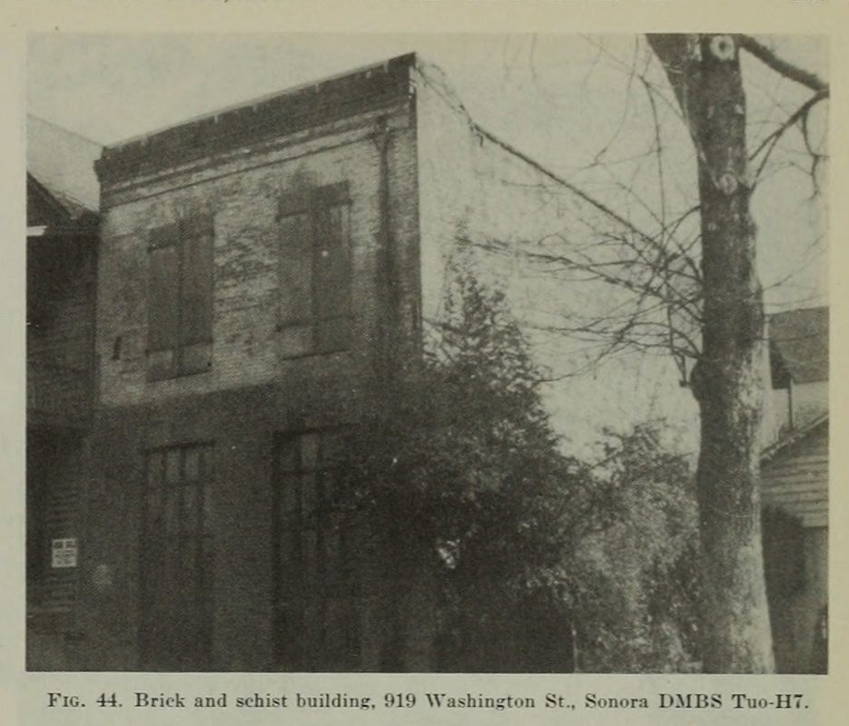 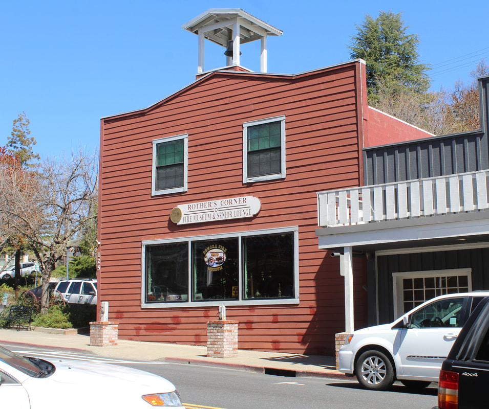 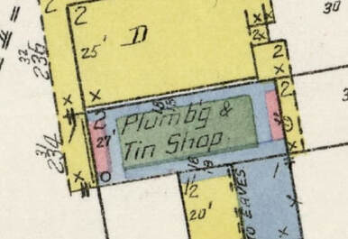 The original structure was built in 1851 and for some time was run as a tin shop. This image from the 1909 Sanborn maps shows that was being used for that purpose into the 20th century. The original structure was built in 1851 and for some time was run as a tin shop. This image from the 1909 Sanborn maps shows that was being used for that purpose into the 20th century. The City of Sonora did something really thoughtful when they re-built the structure. Instead of putting in a Starbucks or Subway, they made the building into a fire museum and senior center. The day I visited I picked up some interesting history about the building from the retired firefighter tending the museum. I'm not buying all of his ideas about why the building came to be (something about having a place where high school kids wouldn't loiter), but he was an absolute gentleman and I appreciated everything he was willing to share. I highly recommend stopping in if you are in Sonora.
Site Visit: May 31, 2021Life is full of opportunities and this building in Diamond Springs, El Dorado County, is one of them. In fact its not just an opportunity for me, but its really an opportunity for both me and my wife. I see an opportunity to own one of these Gold Country historic stone buildings, save it from further deterioration, and make sure it's around for future generations. My wife sees it as the perfect place to open her quilt shop. We really need to act because these opportunities don't always last. As you can see below, the building is currently for sale. 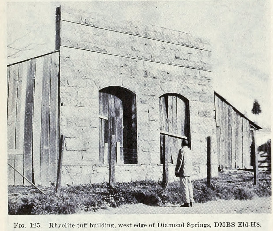  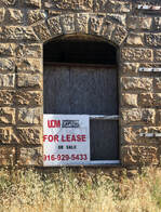 Diamond Springs is one of the oldest towns in El Dorado County. While it did not go on to become one of the largest towns in the county, it is now growing which makes this our opportunity. The proposed plan for the site though is not as a quilt shop. Instead the realtor thinks that the town needs a drive through coffee shop. Really? Put in a Dutch Bros drive thru if that's what you think they need but let's not mess with this unique building. Now we just need a couple of investors, which I guess could be your opportunity.  Can we all agree that a quilt shop fits better with the historic use of the building, not another coffee shop? Visit Date: August 8, 2020I wish there were more of these Masonic and IOOF Halls in as good of condition as the ones in Volcano, Amador County. It's heartbreaking to see so many of these in their dilapidated state as you travel through the towns of the Gold Country. While these buildings didn't seem to have much activity going on with them, at least they are being well maintained. 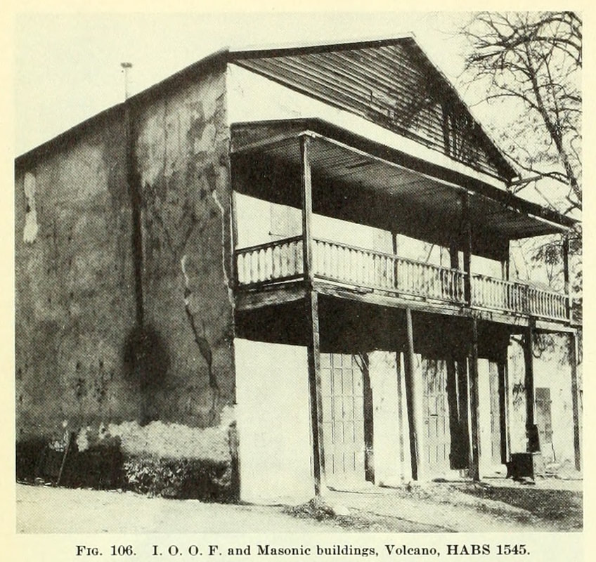 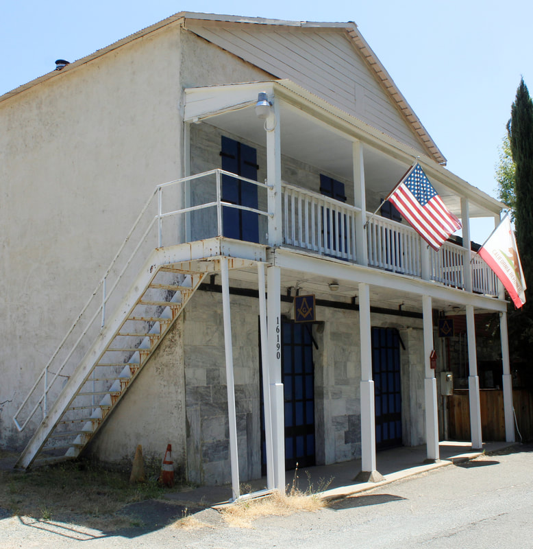 The IOOF/Masonic building is one of many constructed of blue limestone in Volcano. These structures have made it an attractive spot for visitor to photograph. The Division of Mines included eight photographs of Volcano in Bulletin 141, the most of any location in the publication. In the 1930s this particular building was even researched and photographed for the HABS national survey of important historical architecture. The before photo above was from the HABS survey and re-used in the 1948 bulletin. Other photos for the HABS survey are shown below. 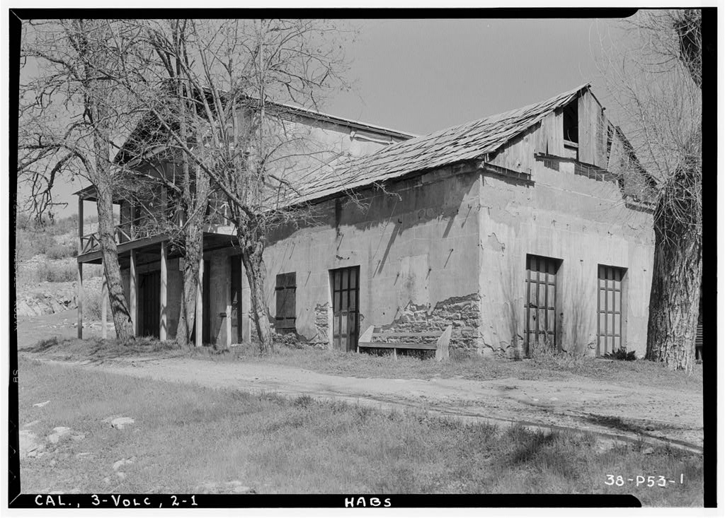 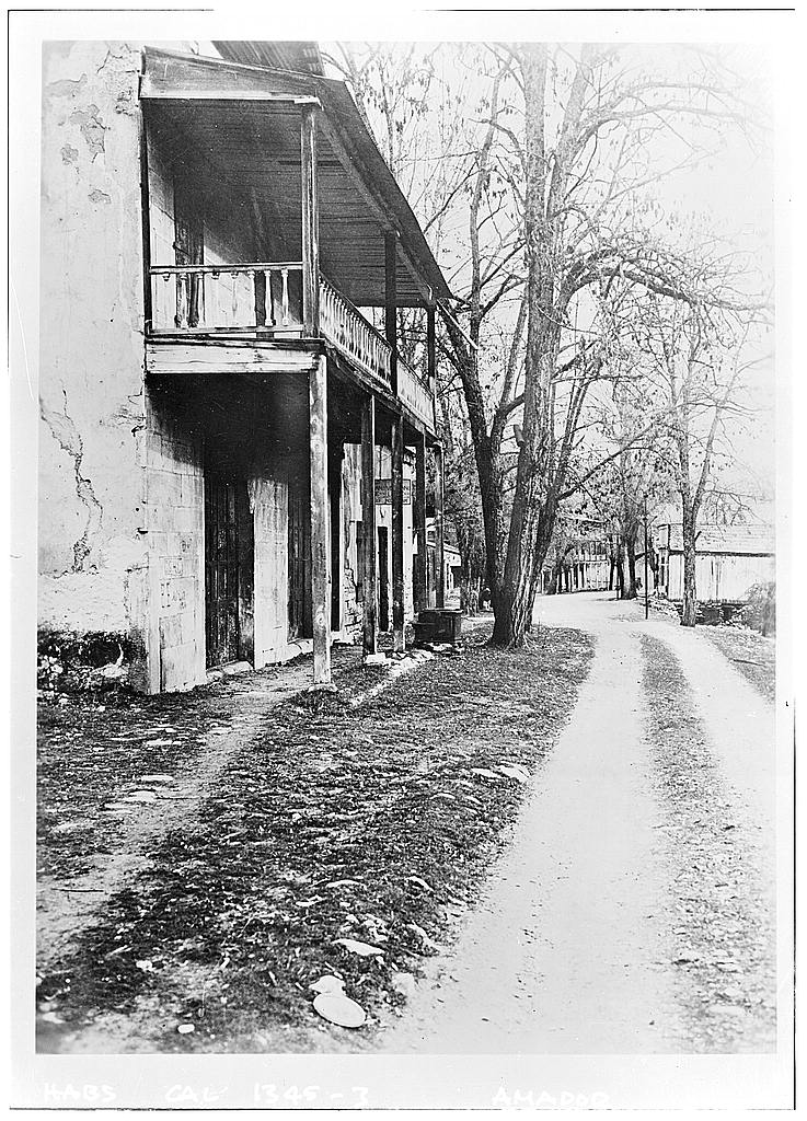 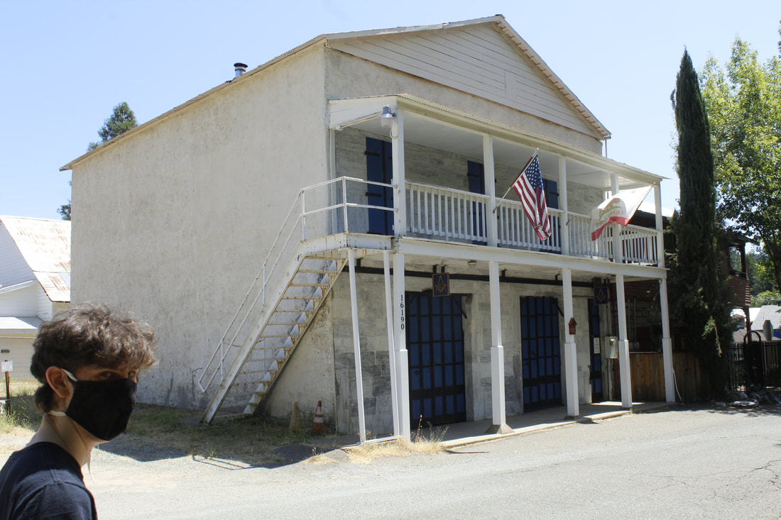 Hey Jake - Could you move a little more to the left? Thanks Hey Jake - Could you move a little more to the left? Thanks This site visit also featured one of the few cameos from my family during this project. Jake unfortunately stepped a little close to the camera while we were trying to find correct angle for this building. Say "Hi Jake!"
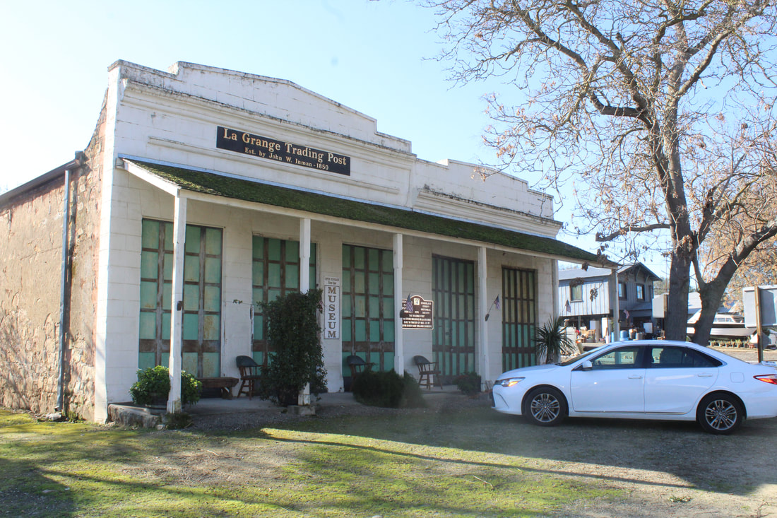
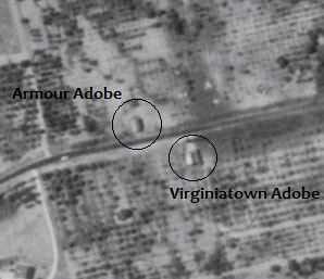
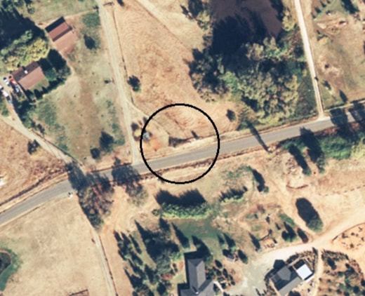
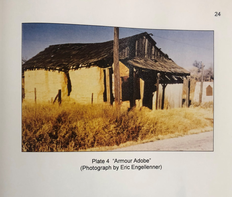
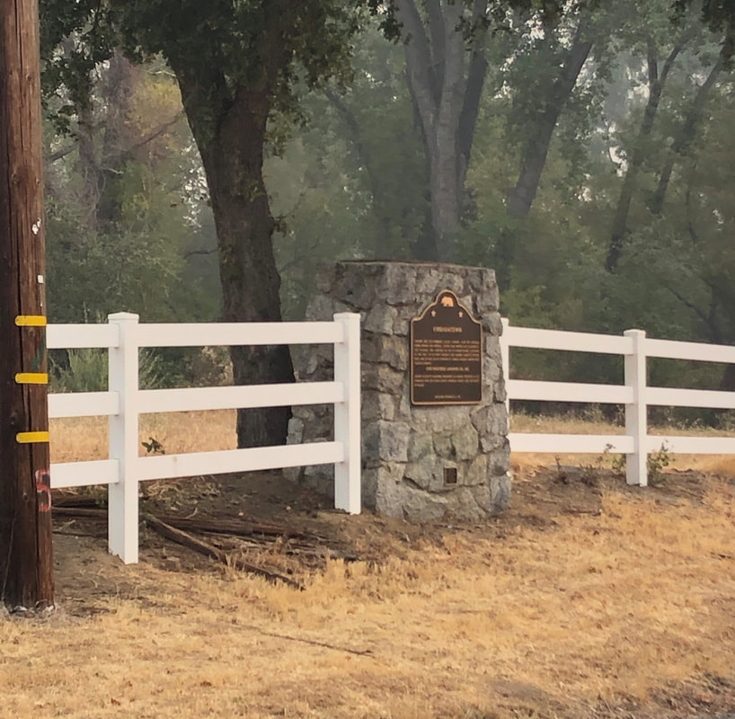
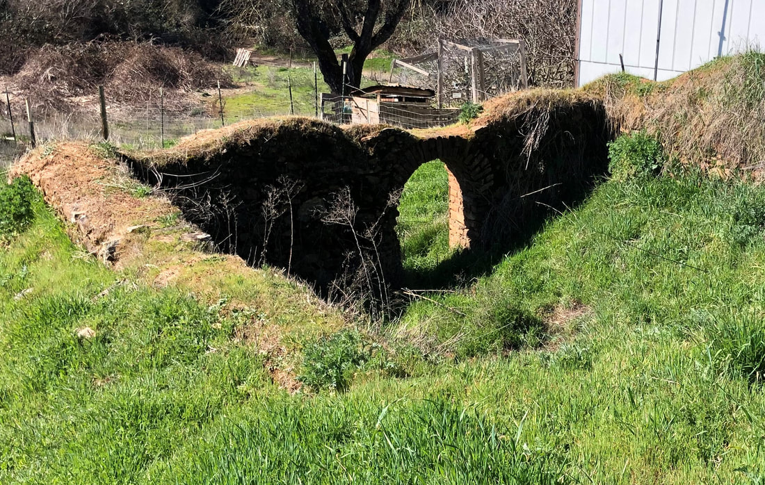
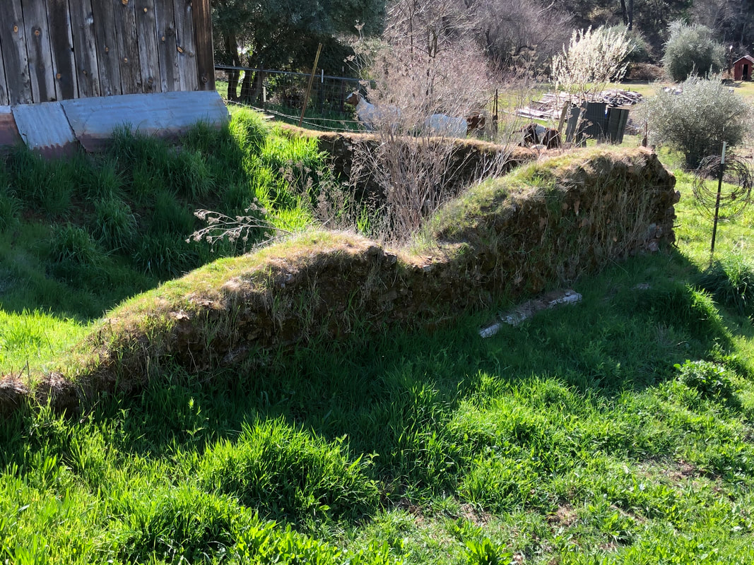
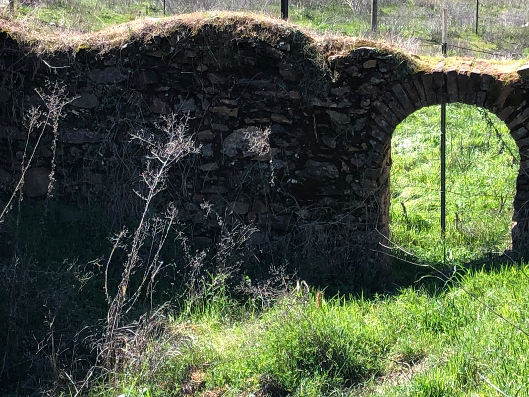
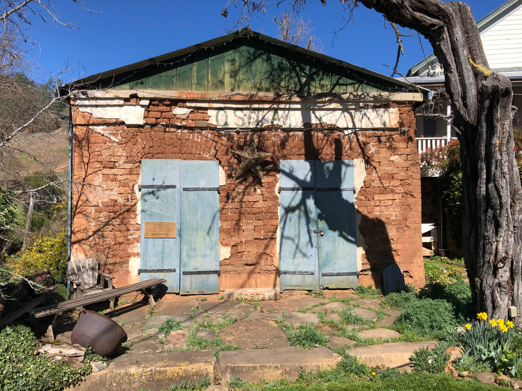
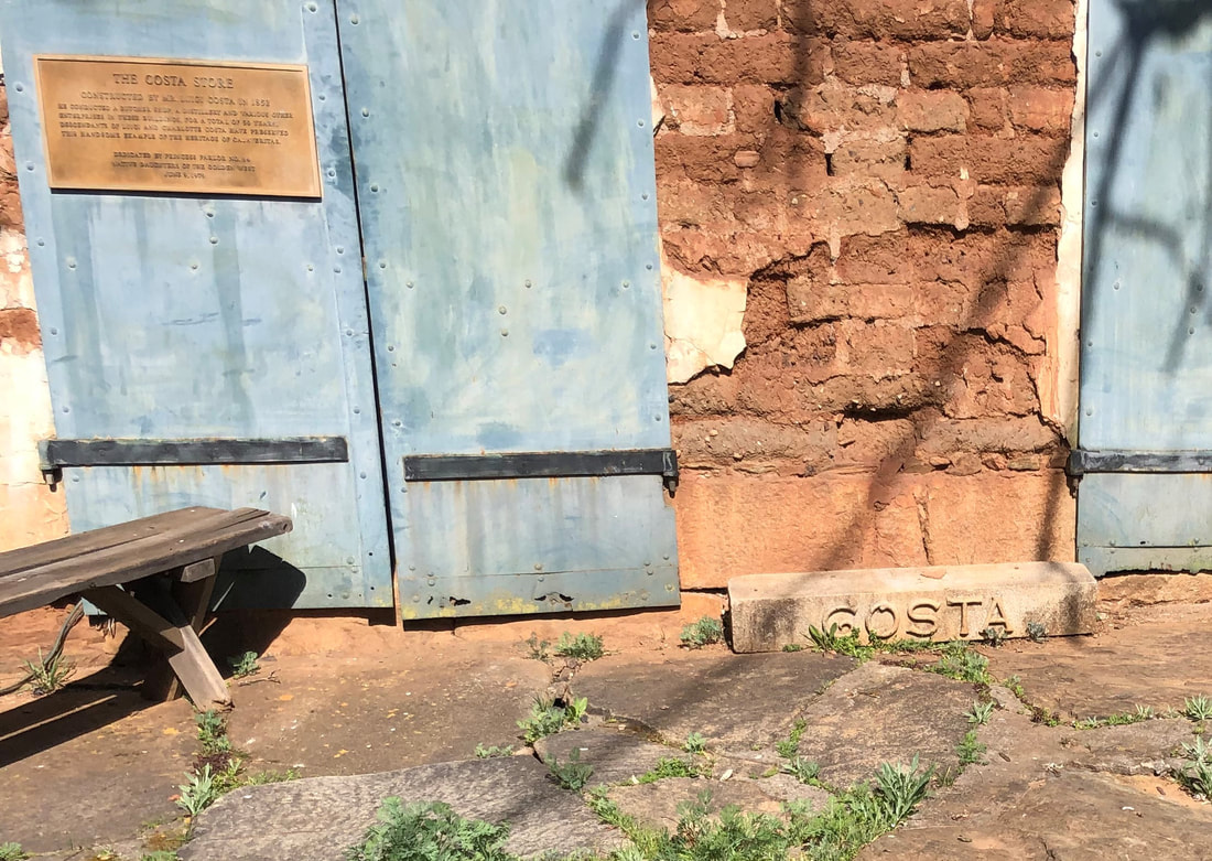
Site Visit: January 18, 2022When I plan a visit to photograph the Gold Country buildings, I have several details I like to work out in advance. First, can I find the building on Google Maps? What route should I take to get there? And, especially important, where will I eat lunch? Fortunately, for the Sandstone Buildings in La Grange, Stanislaus County, the answer to the first question was easy. Yes, these buildings do exist, however I should have played more attention in comparing the Google image with the older photos before I left that morning. 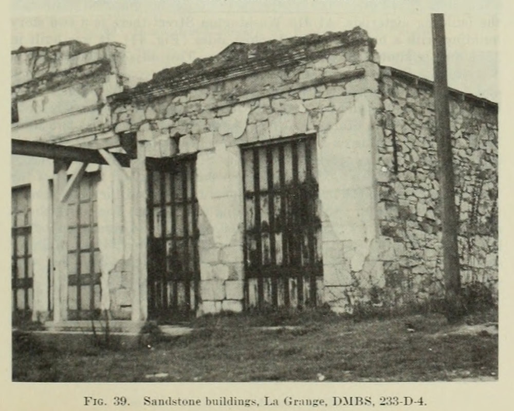 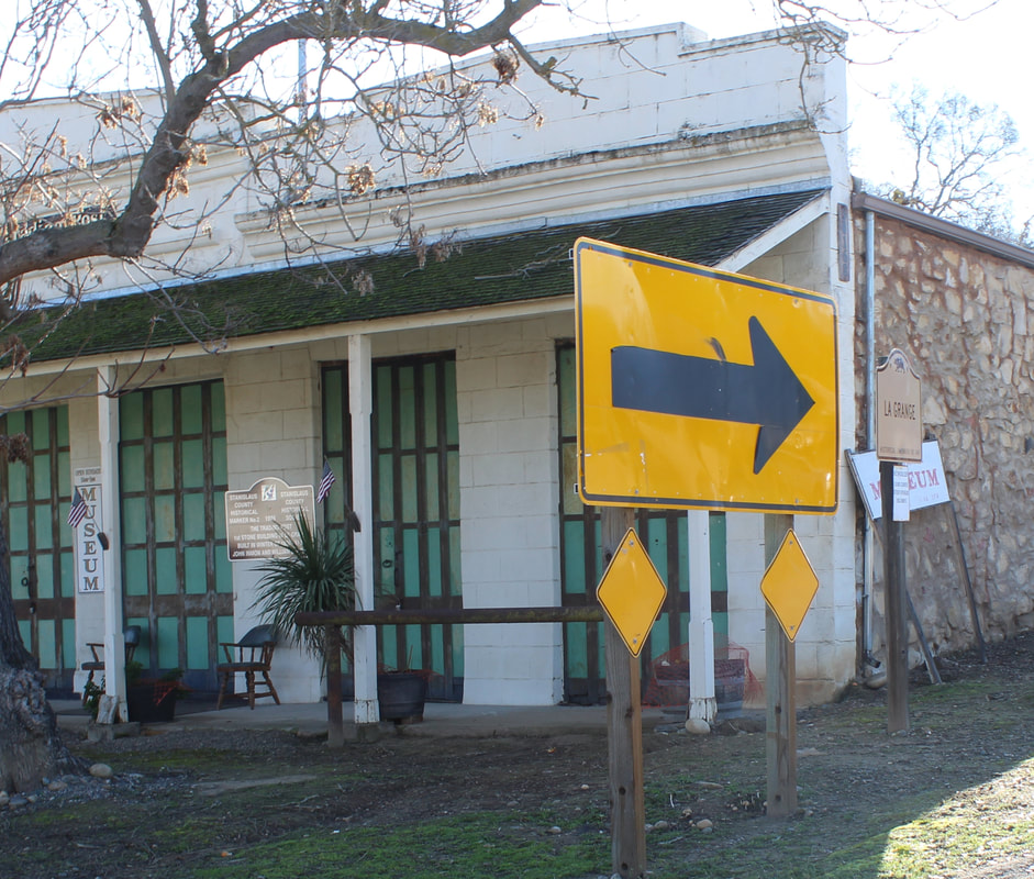 Why did I need to plan out this trip better? I should have paid greater attention to the direction I would be taking the photo. I knew what time I was leaving my house and the time I would likely get to La Grange. I knew the direction I was going to be taking the photo. I should have put those two together and have anticipated that I would be taking a photo toward the southeast, right directly into the low sun of a winter morning. 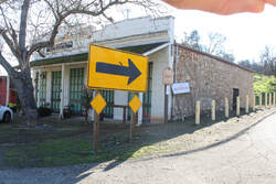 A better prepared photographer, just a better photographer, would have been able to deal with the glare problem I had shooting directly towards the sun. Me though, here was my solution. Put your hand up to make a little shade so that you can just get a photo. Check out my fingers in the photo to the left.  Iron Doors. From Birmingham, England? Probably not. Iron Doors. From Birmingham, England? Probably not. The other photos of La Grange were actually pretty good. The buildings today serve as the museum for La Grange. The day I visited an old-timer who works at the museum had dropped by to update a log they keep of other old-timers who had passed away. Super pleasant gentleman, although he must have thought I knew much more about the building than he did. He wanted to know if I knew where the iron doors were manufactured. I thought he was setting me up to leave me awed that they had come from England. Instead, he was really curious where the doors were from. If any of my historic preservation people have an idea, please let me know and I'll pass it along. Site Visit: May 8, 2021A visit to Mom’s, but first a quick re-cap. So what is this blog about? In 1948, the 100-year anniversary of the discovery of gold at Coloma and the beginning of the California Gold Rush, the state Division of Mines published a ceremonial bulletin called Geological Guidebook Along Highway 49 - Sierran Gold Belt: The Mother Lode Country. Within the guidebook is a chapter written by two prominent archeologists called "Survey of Building Structures of the Sierran Gold Belt". The writers traveled the Gold Country north from Mariposa to Downieville. Along the way they documented still existing stone and clay buildings built between 1850-1870. My objective is to discover if these building still exist and then try to re-create as near as possible the photographs they took for the survey. Some of these buildings are hours from my house in Sacramento. One of the easier sites to get to though is the Rammed-Earth Adobe in Virginiatown, Placer County. That's because it’s just a few miles from Mom's house in Lincoln. It makes it a fun one to poke around looking for, and this one took some looking. 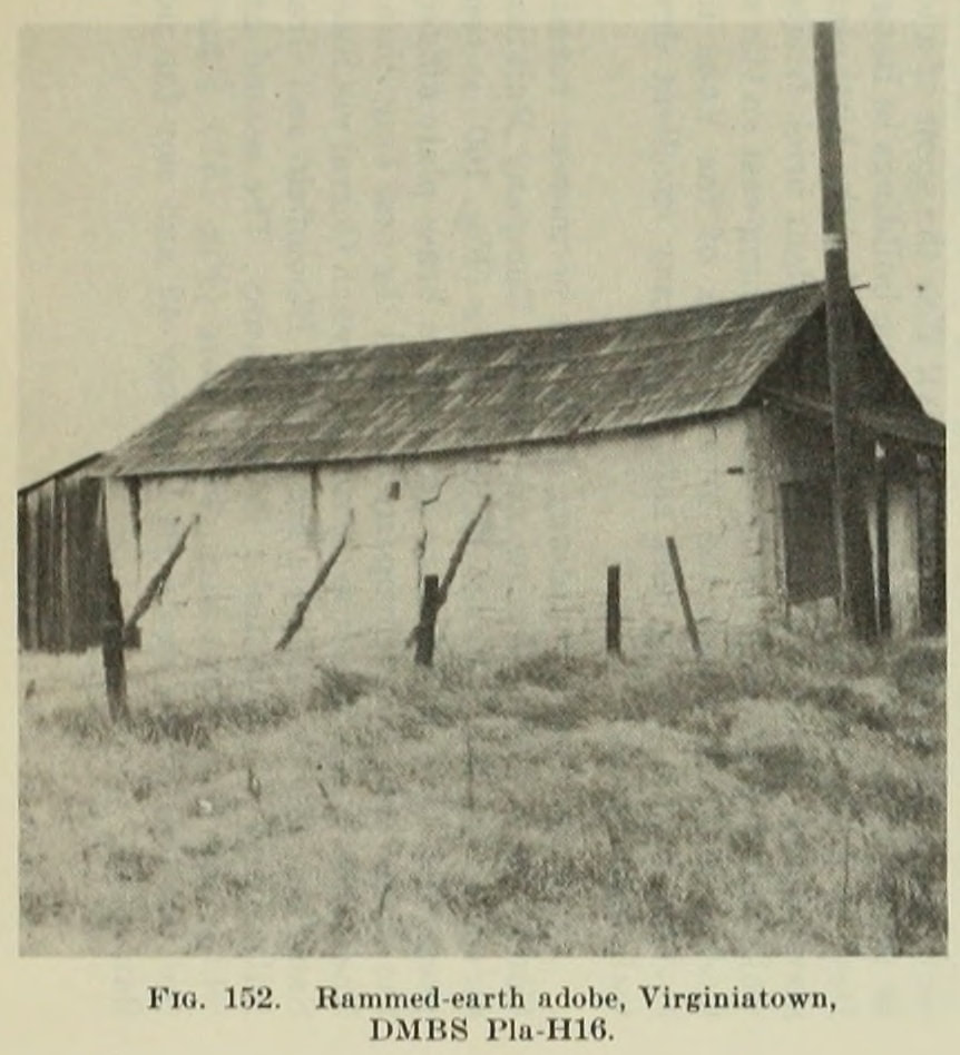 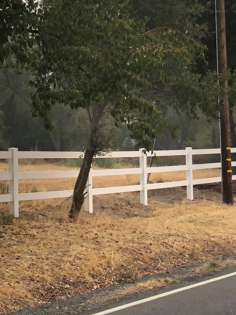 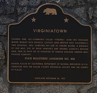 As you probably noticed in the pictures above, my repeat photograph lacks a building. Sadly time has not been kind to Virginiatown. No buildings from the Gold Rush still exist. This is despite the fact that the town had some notoriety. California’s first railroad (really just carts pulled by horses over a rail) was used in Virginiatown in 1852 to move gold-bearing gravels from Virginiatown to Auburn Ravine. Also, the building shown above and subject to this search was supposedly the butcher shop where the Armour meat packing company got its start. This is almost assuredly not true, but it is a fun "fact" often repeated about Virginiatown. I knew nothing about the building when I first attempted to find it. But an internet search gave me a few clues, such as a few black and white photos, but no intel on the exact location or if it even still existed. Google maps is usually good for recon from the home office, but street view and a fly over only got me the location of the State Landmark plaque above. Perhaps an old map would help? 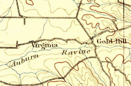 The earliest USGS topo showing Virginiatown is this one from 1893. For a town that once had over 2000 people including a general store, butcher shops, livery stables, post office, saloons, and a racetrack, there wasn't much left by the early 1890s. It did appear that most of the buildings were on the north side of the road, like the plaque, so maybe that would help in the search. Maybe you’re asking, "But what about those black and white photos you mentioned? Surely they can help with the search." Good point! Let's take a look. State Parks has an amazing photograph collection, part of which they are sharing on their website. Among the images are these below, taken in 1931 by Harry Peterson. Based on these images, it looks like there were only two buildings, both adobes, left by this time. The photo on the left faintly shows both buildings, one on each side of the road. Since the Sierra is in the background, we know the photographer was facing east. And from the other two pictures, it’s easy to see that the nearest building on the north side of the road is likely our target. Closing in! 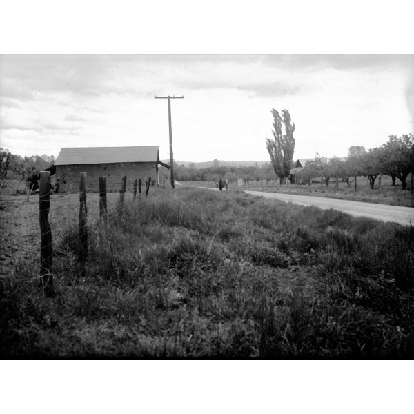 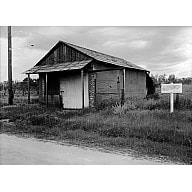  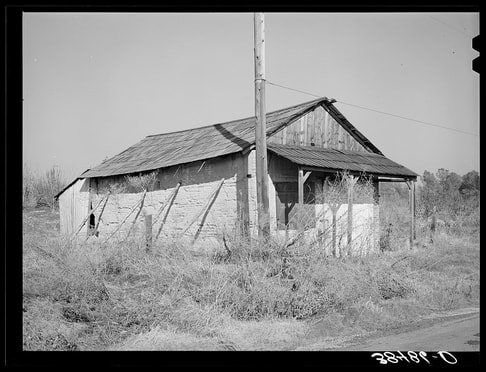 To confirm that this is the right building of the two, we can look at photos taken in 1940 for the Farm Security Administration. Their photographer was sent to document the Placer County countryside during the Depression. And then luckily these images ended up with the Library of Congress, who then put them on the internet. Oddly, the photographer called the building an old bank. He was probably right though in saying it was being used now as a barn. Also note the flagpole seen in this and earlier photos. 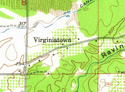 The USGS published a new map of the area in 1954. These two buildings appear near each other on the map. The so-called Armour Adobe is the square dot below the letter "O" in Virginiatown and the other building is the dot on the south side of the road. I was able to then find an image of the adobe was from the early 1960s. UCSB has an amazing aerial photography collection with locator. And they allow you to download many of the photographs. After a little searching, I found this flyover from 1962 showing the two buildings. The follow up from 1999 though indicates the buildings were destroyed by that point. So where exactly was the building? Well, it finally donned on me that I did know something about Virginiatown. While in college I worked at an archaeological information center on Sac State's campus. At that time one of the digs the archaeology department was conducting was the Virginiatown Adobe in the photo above. Not the building I wanted but close enough to get some great information. At least 5 theses were written about the dig and Virginiatown. They confirm that the Armour Adobe was misidentified. Both adobes were in the Chinese section of Virginiatown. One of the theses held the smoking gun that would have saved me of all this research. Based on a photo from it, the Rammed-Earth Adobe was just to the left of the present-day historical marker. I'll need to take a much better picture next time I visit Mom. Site Visit: February 29, 2020In the late 1990s I was the County Archivist in one of the Gold Rush counties. We didn't get a lot of researchers so I was able to spend a lot of my time going through the records myself. While indexing the court records from the 1850s I conceived a brilliant idea for a TV show. I'd use the stories from the court cases as the basis for the storylines for my show. Sort of like Erle Stanley Gardner did with Perry Mason, only set in the Gold Rush with an honest-as-the-day-is-long, handsome sheriff solving the crimes, often with the help of his neighbor, the attractive and sharp as a tack schoolmarm who are both secretly smitten for each other. (If we can get to picked up for a season 4, we'll even get to see them hook up!) If I had to pick a location to set the show in it would be the quaint Calaveritas in Calaveras County, where I went to see the historic adobe house on Main Street. 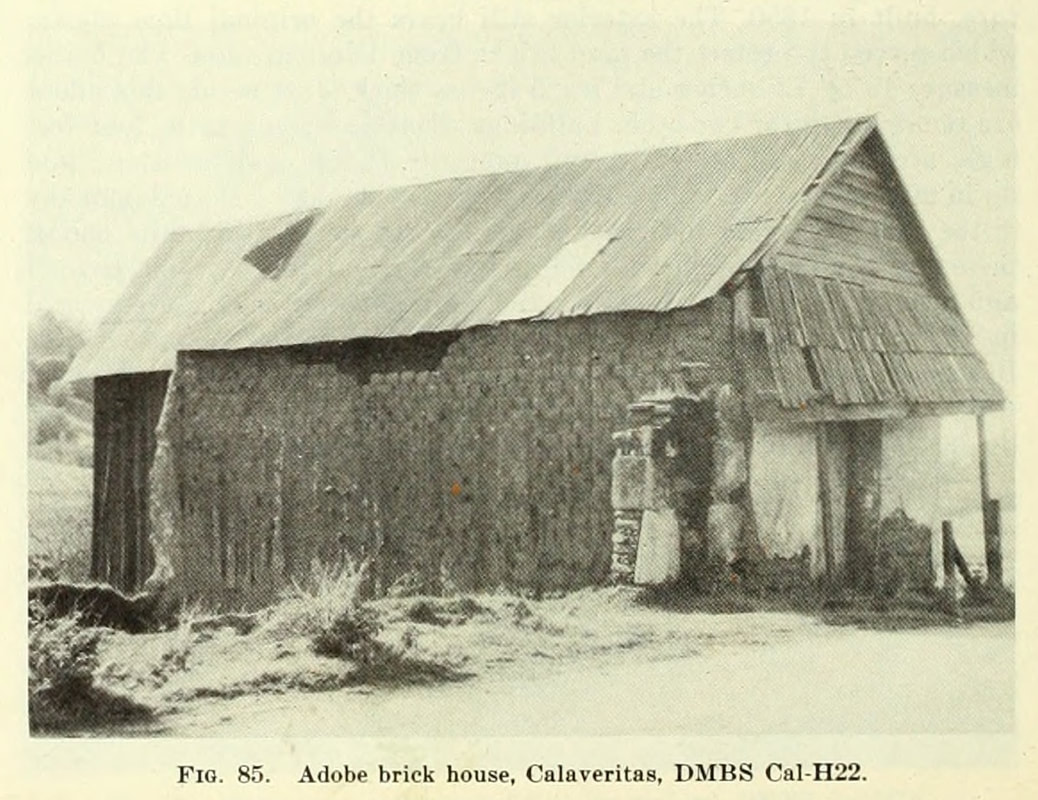 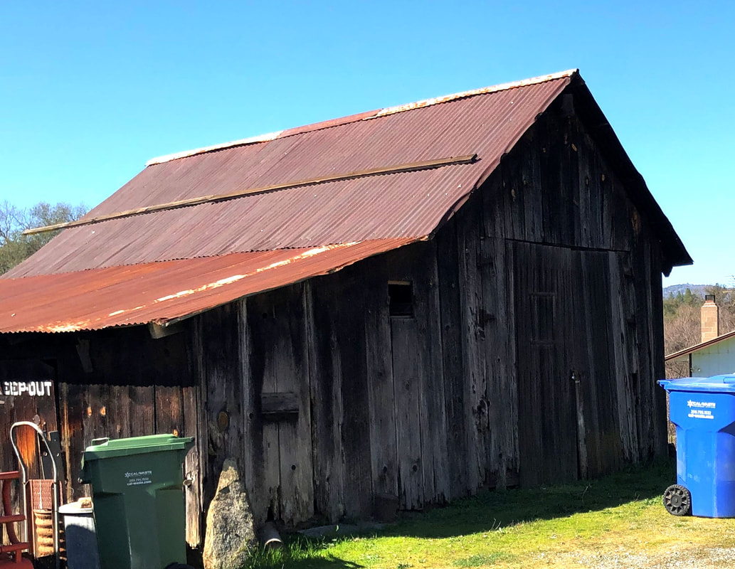 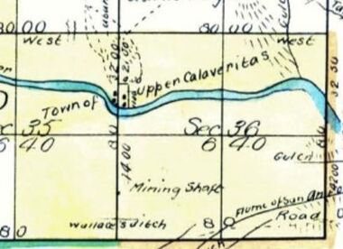 1869 General Land Office Plat for Township 4 North, Range 12 East, MDM showing Calaveritas. The surveyor wrote that he had trouble conducting the survey since "The houses in the town being so disposed as to render chaining on the true line impossible, I took an Offset of 4 chains east." 1869 General Land Office Plat for Township 4 North, Range 12 East, MDM showing Calaveritas. The surveyor wrote that he had trouble conducting the survey since "The houses in the town being so disposed as to render chaining on the true line impossible, I took an Offset of 4 chains east." Calveritas sits in a beautiful small valley, about 4 miles to the east of the county seat San Andreas. Running just south of town is the previously very prosperous Calaveritas Creek. At one time it was a booming mining town with as many as 2000 people from all over the world. The town bustled with Americans, Chinese, French, Mexican/Sonorans, Italians, and other Europeans. It must have been remarkable to see. If given the chance, go visit. Especially in early spring when the grass is green, and the air is still crisp. What makes it nice is that the town is not directly on Highway 49, so it has a slow (in a good way) feel. There are only a few historic buildings left in Calaveritas, including the adobe house. Although I swear it looks more like it was a barn than anything. I'm pleased that the adobe brinks are being protected with the wood siding. However I would have loved to have seen it as the 1948 Division of Mines building survey did when they traveled there. They described the structure as having been built in 1850 and still having the original lime plaster to protect it. They also noted that "just beside this adobe are the remnants of two other buildings whose basement walls, four feet high....(E)ach has an arched doorway." Seeing these relics was nearly as gratifying as the adobe. The best-preserved buildings in Calaveritas are at the north end of town. These buildings, the Costa Store and Cuneo house, seem to beam with pride at having conquered the ages. It must be a testament to their owners through the years that they are both in such good condition. The Costa Store, in particular, provides an excellent view of how well the adobe bricks have held up over the years. 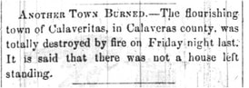 San Joaquin Republican, August 4, 1858 San Joaquin Republican, August 4, 1858 Calaveritas never recovered from a fire in August 1858 that destroyed nearly all of the town. Maybe we are even lucky to have just these buildings, based on how ominous the early accounts were. 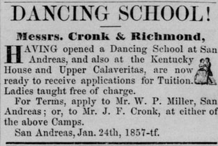 Before the fire though, the town knew how to have a good time. You can tell because they even had a dance school. At one point it had 60 men signed up for lessons. No word however on the number of women. They probably needed to know how to dance with all of the balls and parties that were held in the town. They used just about any occasion to hold a ball including the 4th of July and even the inauguration of a new president. I'm sure I could have even crafted a story for my show from the dance school and balls. 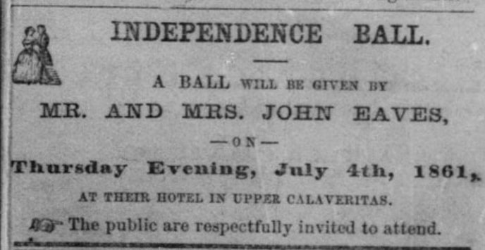 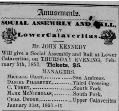 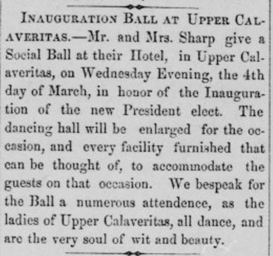 |
AuthorMy name is Jeff and I am on a hunt to find historic brick and stone structures along Highway 49. Archives
January 2022
Categories
All
|
||||||
 RSS Feed
