|
|
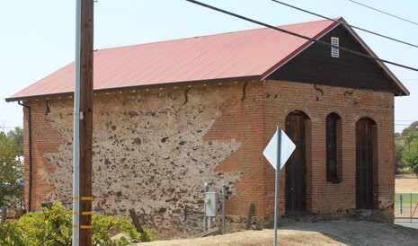
Visit Date: August 8, 2020I wish there were more of these Masonic and IOOF Halls in as good of condition as the ones in Volcano, Amador County. It's heartbreaking to see so many of these in their dilapidated state as you travel through the towns of the Gold Country. While these buildings didn't seem to have much activity going on with them, at least they are being well maintained. 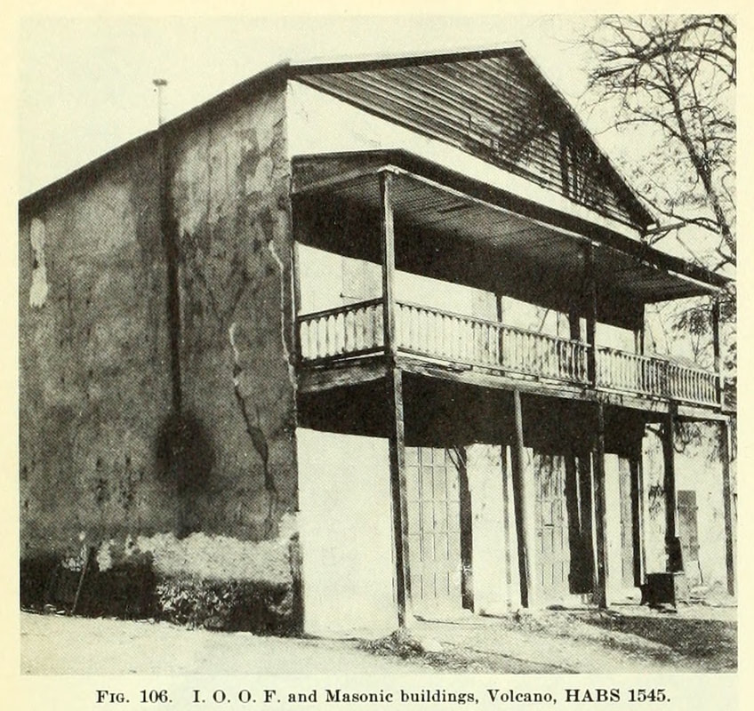 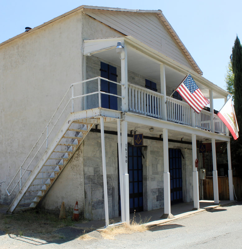 The IOOF/Masonic building is one of many constructed of blue limestone in Volcano. These structures have made it an attractive spot for visitor to photograph. The Division of Mines included eight photographs of Volcano in Bulletin 141, the most of any location in the publication. In the 1930s this particular building was even researched and photographed for the HABS national survey of important historical architecture. The before photo above was from the HABS survey and re-used in the 1948 bulletin. Other photos for the HABS survey are shown below. 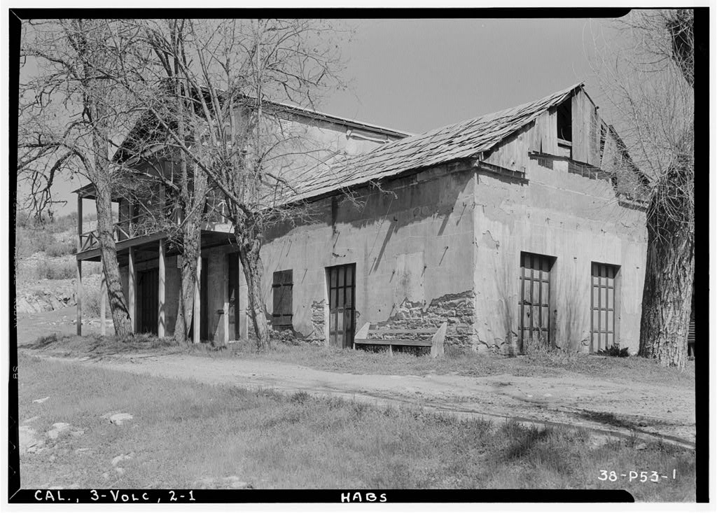 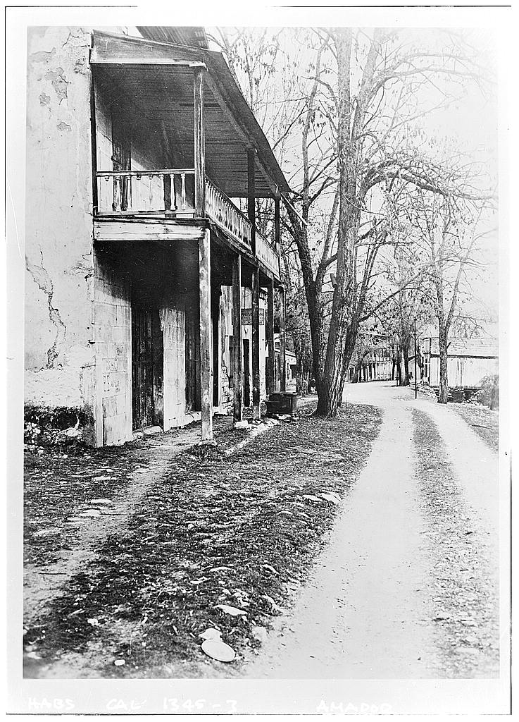 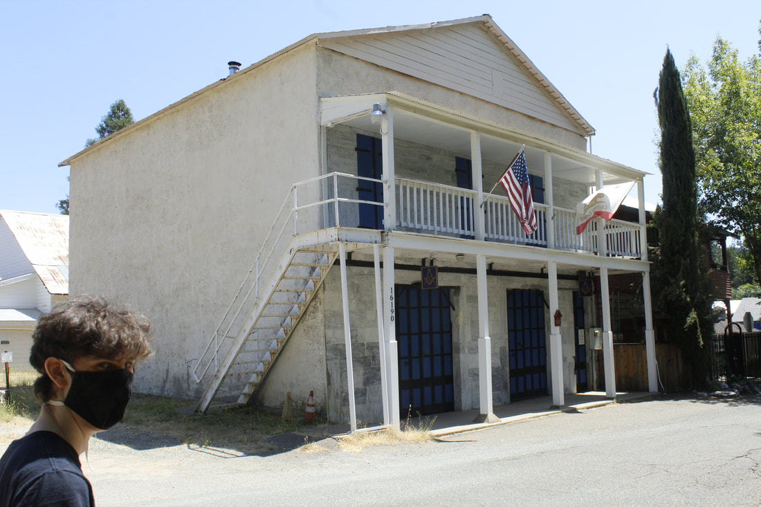 Hey Jake - Could you move a little more to the left? Thanks Hey Jake - Could you move a little more to the left? Thanks This site visit also featured one of the few cameos from my family during this project. Jake unfortunately stepped a little close to the camera while we were trying to find correct angle for this building. Say "Hi Jake!"
1 Comment
Visit Date: July 5, 2021
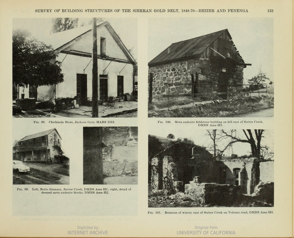
In my attempt to find and record these old stone buildings along Highway 49, I get to travel the Gold Country. I'm often shocked at how many spectacular buildings still exist. I’m especially impressed with how many of the Gold Rush towns are still charming and awe-inspiring. Some of their main streets are a step back in time (Visit Murphys if you want to see what I mean). One of the most popular towns to visit along Highway 49 is Sutter Creek in Amador County. The town is a haven for antiquing. Knowing that, I cannot understand how the authors of the Highway 49 study photographed 3 buildings for the Sutter Creek entry and not one of them was from the charming core of the town. Instead, we get two buildings in the foothills to the east and the Botto Granary, just south of Sutter Creek, which is documented here.

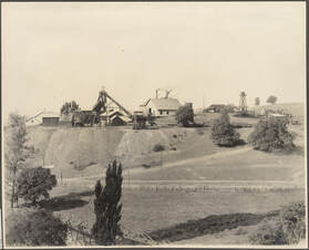 Central Eureka Mine, circa 1915. Botto Granary just, just, just out of sight at left. Central Eureka Mine, circa 1915. Botto Granary just, just, just out of sight at left.
I shouldn't be too harsh on the Botto Granary building. It's not the building's fault that there are much nicer, sturdier, and still in use structures less than a mile away, lining the main street in Sutter Creek. Maybe in 1948 it was an excellent representative of Gold Rush architecture, more so than those buildings. I'll give the Division of Mines survey authors’ credit though, once again they sought out and photographed a former bar, which seems to be a theme for the buildings they recorded.
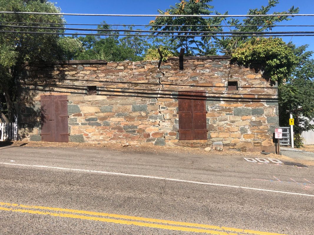
In the 1948 survey the building was described as: "Across the highway from the Central Eureka mine on the crest of Sutter Hill is the Botto Granary built in 1869. It is of dressed field stone (andesite breccia) obtained in the property. With its iron doors and plastered interior, it stands as an excellent example of the enduring architecture of the Mother Lode." So apparently, I'm not much of an architectural historian. I was rather unimpressed with the granary. However, note the iron doors below. I guess they are pretty nice(?) 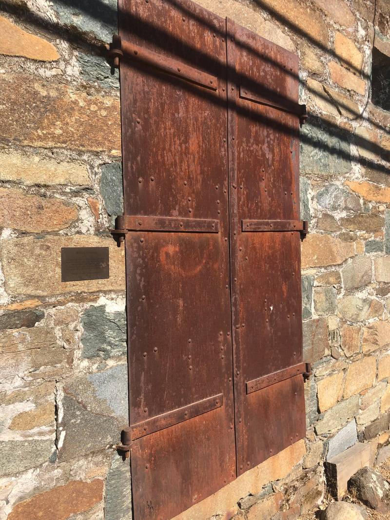
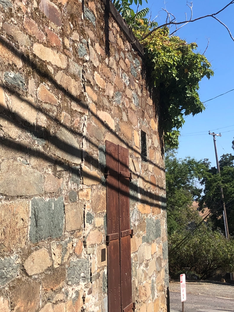
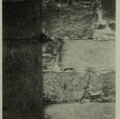
This site visit unfortunately did caused me to violate my one cardinal rule: Stay off of private property. The entry in the guidebook had two images, the one at the top of this post and the one at left showing detail work of the stone construction. I tried to re-photograph this but I wasn't able to find the pattern shown on the front of the building. Can you? Please let me know if you can find it in the image below.
Detail of Meta-andesite blocks but no match to the image above.
Because I couldn't find this pattern of stones in the front of the building, I assumed it had to be in the back. To check this out I had to walk onto the porch of the house next door. The house is beautiful and looks exactly like a B&B, including a welcome sign on the wrap around porch. Long story short, the angry dogs barking inside the house were mad at the guy just outside of their private residence, which is definitely not a B&B. It kinda ended like "Oops. Sorry about that. Didn't mean to trespass. But do you mind if I look around back? What's that? Of sure, I'll leave now. Have a great day."
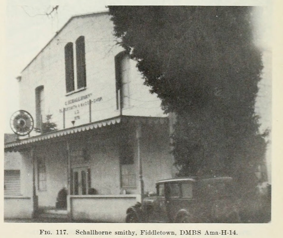
Visit Date: May 1, 2021The one thing that always gives me joy is to drive through the California foothills in the spring. The green hills with all of the different blooming wildflowers though can make me a danger on the road. I have tendency to swivel my heads trying to identify as many of the flowers and shrubs as I drive these backroads. This was what made my trip to Fiddletown in Amador County doubly enjoyable. Tons of wildflowers as well as a number of historic stone buildings, including the Schallhorn Blacksmith and Wagon Shop. 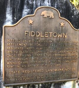 For historic structures, Fiddletown is certainly more well-known for its buildings associated with the Chinese, in particular the Chew Kee herbalist shop (which we will eventually get to). These Chinese buildings are at the western end of town. The Schallhorn building thought sits at the eastern end, amongst a number of other beautiful historic buildings. The building is exceptional in its solid construction and integrity. As much as any of the buildings I've visited, it looks like it last for generations to come. 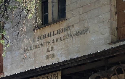 According to the marque on the front of the building, it was constructed in 1870 for C. Schallhorn as a blacksmith and wagon shop. After a little searching, it's not surprising that Christopher Schallhorn invested in building such a fine structure. He seems to have been a true innovator. Enough so that shortly after having the building constructed, he filed for and received two patents. With his partner Frederick Knapp, in 1876 they received a patent for a safety-guards or cock-eyes for a harness. He was really big on safety.  The following year, they again put their heads together and came up with a better way. This time they patented a way better Buckle and Snap-Hook. Don't believe me, check this out. 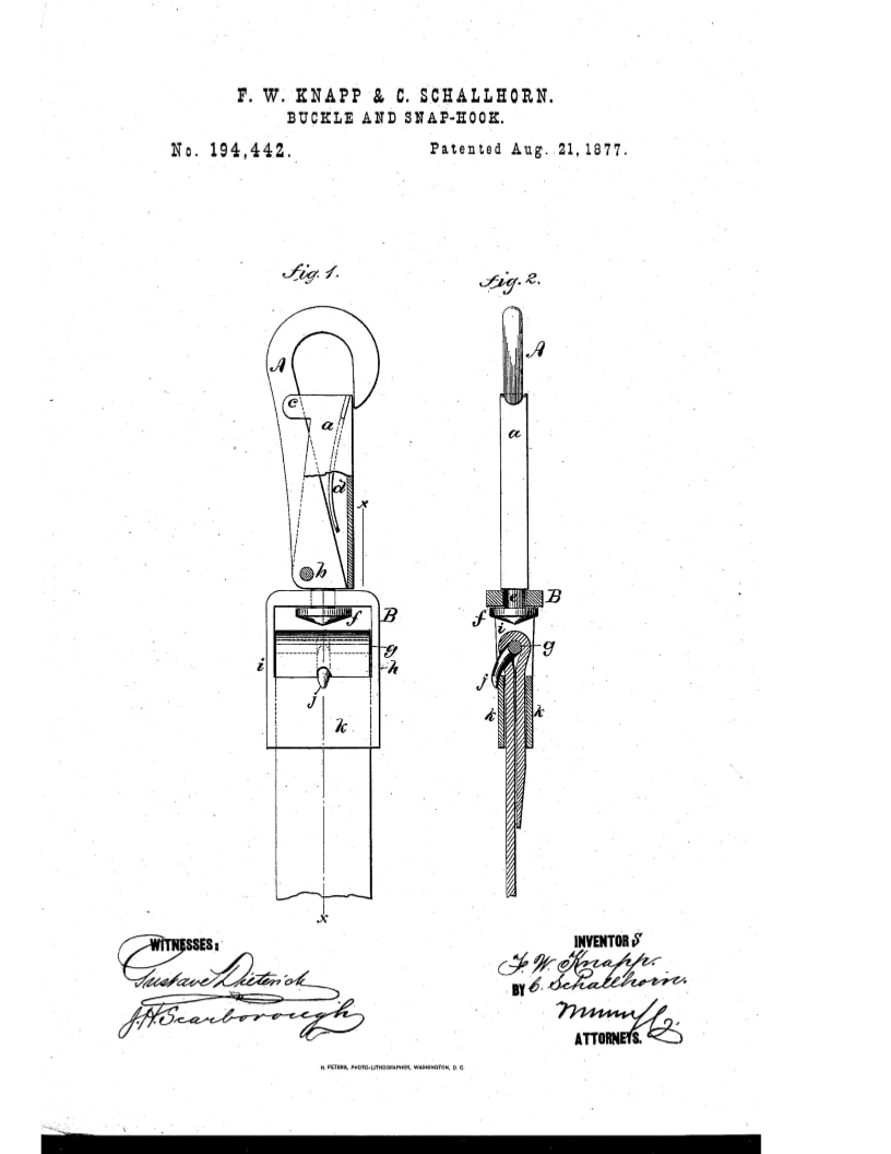 According to the authors of the Bulletin 141 Building Survey, the blacksmith shop was constructed "of rectangular hewn blocks (measuring 12 by 18 by 10 inches) of Valley Springs rhyolite tuff which is easily worked when first quarried but hardens after exposure." I've left myself some work to do in the future since they also wrote that it was taken from a quarry "about 1.5 miles east of Fiddletown (that) may be seen across a field to the south of the road." I didn't take the time to track the quarry down on this trip so I need to return and do my best to find it with just that sketchy description. (Maybe this is it!) Hopefully it'll a beautiful spring day.
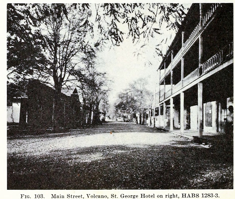
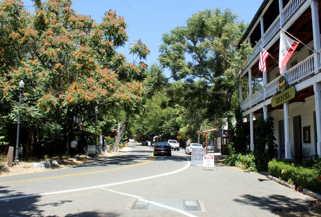
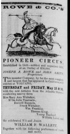
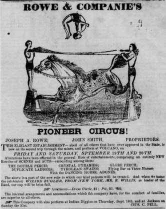
Visit Date: August 8, 2020 Most of this hunt to find these old buildings has been a solo quest. Get up early on a Sunday morning, down a cup of coffee, load a good podcast like All Night with the Living Geeks, and head to the Gold Country before anyone else is out of bed. I love the lone pursuit, where I can take all the time needed to find the building, set up the correct angle for the repeat photography, and explore any of the back roads I might across. This site visit though was different, I tricked my family into coming with me. 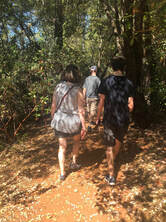 With a promises of stopping for burgers on the way home my wife and kids all headed for Amador County on this morning. The first stop and supposed reason for the trip was to hike at Indian Grinding Rock State Park. After recovering from heat sickness from hiking in the August heat, I sprung the real reason for the trip on them. A "quick" side trip to Volcano, which is only like a mile from the park. (Don't check my math, it might be a little longer if you ask my wife . Volcano is a beautiful town though. (Probably nicer when the temperature is under 100 degrees!) The authors of Bulletin 141 (see the About for more info) even refer to it as "the most picturesque of all the Mother Lode towns." After a quick walking tours of all the sites, we set out to take some pictures. The scene above was easy enough to find but I wish I stepped a couple feet to the left for a better angle. I also wish I had re-made the actual shot. The photo used in Bulletin 141 wasn't actually taken in 1948 during the Building Survey, but was instead used from a HABS report, probably from the mid-1930s. The Library of Congress has made many of these HABS photos in their digital collecitons. The original image downloaded from the Library of Congress is below. 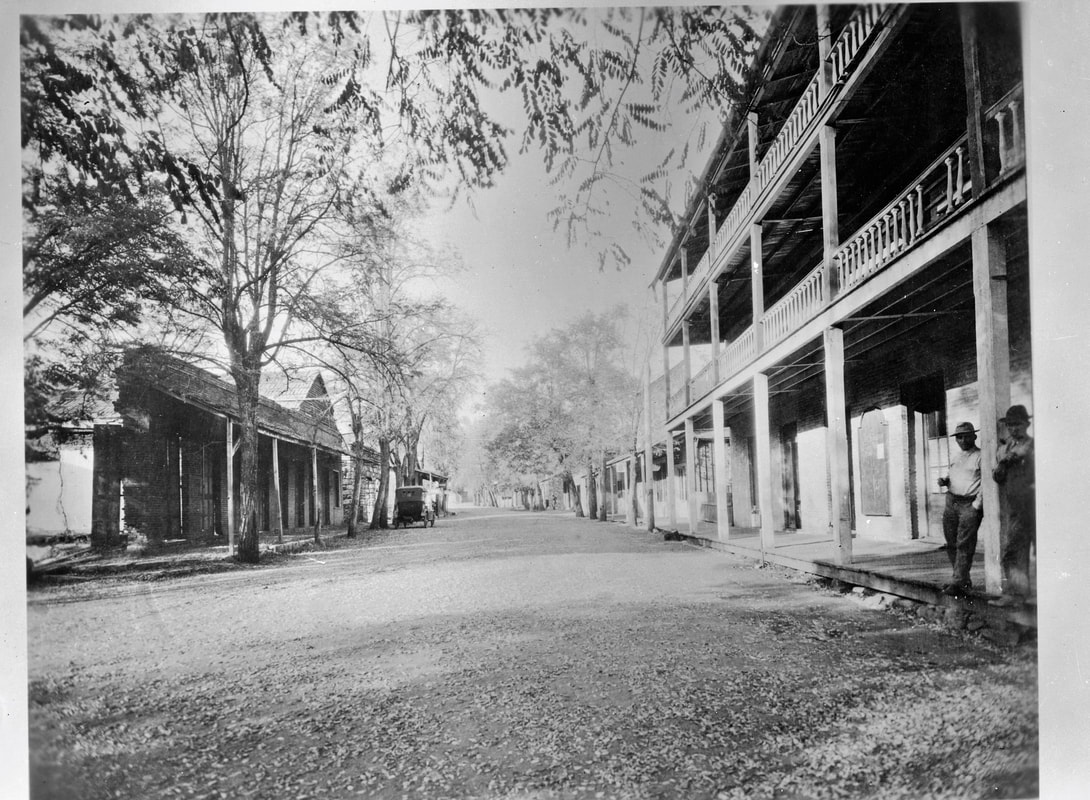 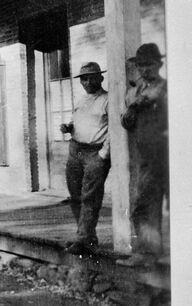 The HABS image is so much clearer than the Bulletin 141 version, as well as uncropped. The Bulletin authors relied upon many of these HABS photos for their publication. I had assumed they traveled to these towns but all of the images from Volcano come from HABS surveys, so.... If I would have known at the time about this photo, I would have made my sons stand next to that post, just like these two old boys, with their drink and pipe.  In doing a little research, you learn that Volcano in the mid-1850s was a going concern. As many as 5000 people lived there, it had the state first lending library, and first astronomical observatory in California. And like many of the major Gold Rush towns, it attracted the CIRCUS. These ads, from the Amador Ledger Dispatch, for circuses at Volcano are just amazing. The two following were from the Rowe & Co. Pioneer Circus, which visited in May and September of 1856. The graphics are unbelievable! In July of the following year, the Shephard & Adams South American Circus came to town.
I'm sure my family would have had a more memorable trip to Volcano if we gone to see a circus. Maybe next time it comes to Volcano, we'll go.
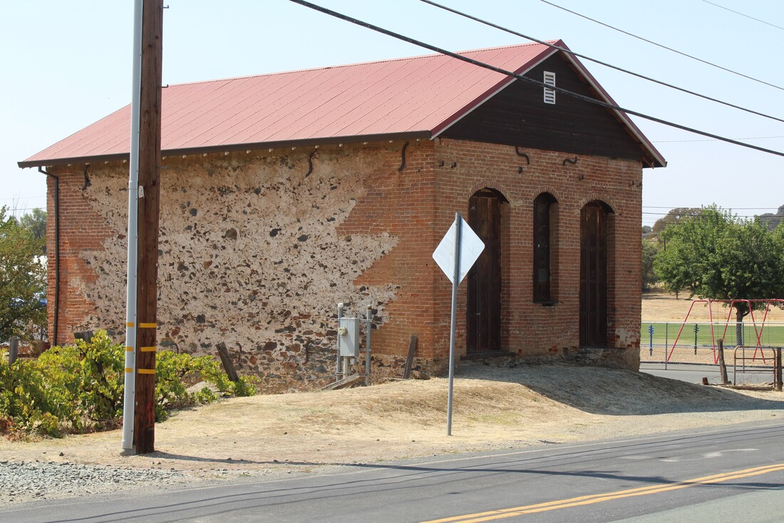
Trip Date: Sunday, September 3, 2018I guess a good place to start this blog would be with my first attempt to document one of the structures from Bulletin 141. So, after years of talking about it I finally grabbed my camera, got in the car, and headed out to the Mother Lode to find one of the cool old buildings. The closest one to my home was in Plymouth in Amador County, so that's where I set my course. Besides, I like the idea of trying to find a rock building in Plymouth. It seems so pilgrim-y. This building was easy to find. It sits at the western edge of Plymouth, on the south side of old road into town from Sacramento. As with all of these sites, before leaving I did a google map search to see if I could find it. I like checking google maps before any trip but especially when going to the Gold Country for this project. I try to not just find the building but also a good place to park and where to stand to get the photo. This building has stood up really well over the years, although there were no clues as to the current use. According to the guidebook, this was "an old and curiously constructed building with a brick front and rear walls which merge step-like into the side walls constructed of undressed fieldstone of meta-andesite agglomerate." And as everyone knows, undressed fieldstone of meta-andesite agglomerate is way better than dressed fieldstone of meta-andesite agglomerate. Taking the photo was the first of a number of uncomfortable experiences I have had while visiting these buildings. It's like the residents have never seen a flatlander get out of his Toyota Camry, set up a tri pod and DSLR, run into the street between traffic, and take photos of random stone buildings. Seems like that would be old hat, but apparently not based on the looks from the Plymouthians. I have since switched to mainly taking photos with my phone since its quicker, less conspicuous, and the photos are usually really good quality. Thanks for following my hunt up and down the Mother Lode Highway .
|
AuthorMy name is Jeff and I am on a hunt to find historic brick and stone structures along Highway 49. Archives
January 2022
Categories
All
|


 RSS Feed