|
|
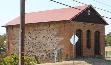
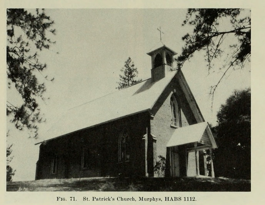
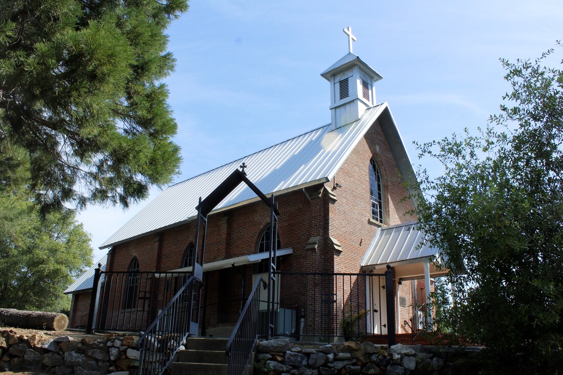
Visit Date: May 16, 2020I really enjoyed visiting Murphys in Calaveras County. The number of historic brick and stone buildings is unparalleled in the Gold Country, IMO. I previously wrote about the Compere's Store which is on Main Street. While Main Street has most of these fantastic buildings, sitting on a knoll above Main Street is wonderful structure that is still in use. The St. Patrick's Catholic Church is a two-story church that looks an awful lot like it did in 1948 when the Division of Mines survey was completed 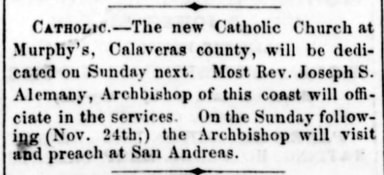 Stockton Independent, November 12, 1861 Stockton Independent, November 12, 1861 Murphys has a quality found in many of the Gold Rush towns and that is it built a number of impressive churches. (Check out the Red Church in Sonora if you wan to see a beautiful old church!) In addition to the St. Patrick's Church, Murphys also has the First Congregational Church of Murphys, which was built in the 1890s. The current St. Patrick's was opened in 1861. It replaced a previous church, which you may have guessed was destroyed by fire. For fun, google "Gold Country St. Patrick's Church". There are a few of them The church is a little ways off the road and hidden by pines and oaks. But I had a siren call to find it. Nearing the church I could hear a sad but beautiful wailing. Only as I drew closer to the sound, did I began to figure out what it was. Bagpipes! A lone bagpiper was practicing his hobby with some friends in the parking lot of the church. As it was peak Covid, there was no one else around until I drove up. Murphys is full of charm and charming people. I assume the neighbors have grown accustomed to this musical treat. 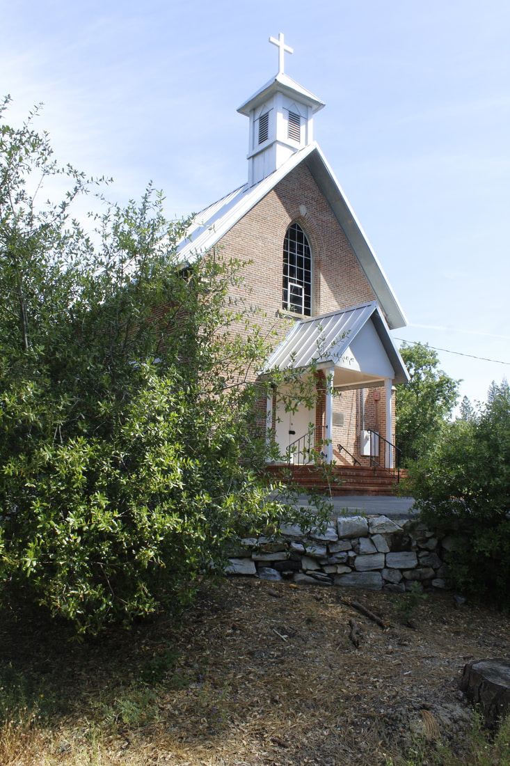 Nice stone work in front of the brock church.
1 Comment
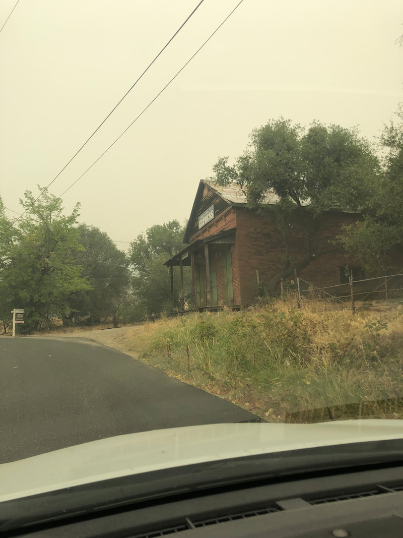
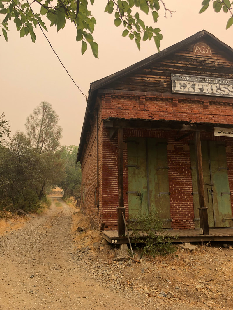
Visit Date: August 7, 2021The buildings in the Highway 49 survey have faced many challenges to last this long. These buildings, some as old as 170 years, having weathered the elements, withstood the neglect of owners, and even survived inexcusable vandalism. I guess that's why I am so interested in tracking down these structures. I want to know if they have they survived? What's their current condition? Are they going to be around for another generation? In visiting the "Wells Fargo" store in French Corral, I found that there is another element that makes me want to rush out to find these building sooner rather later. As we know, 2021 seems to be the year of the wildfire, with many of them threatening a lot of these old brick and stone buildings. 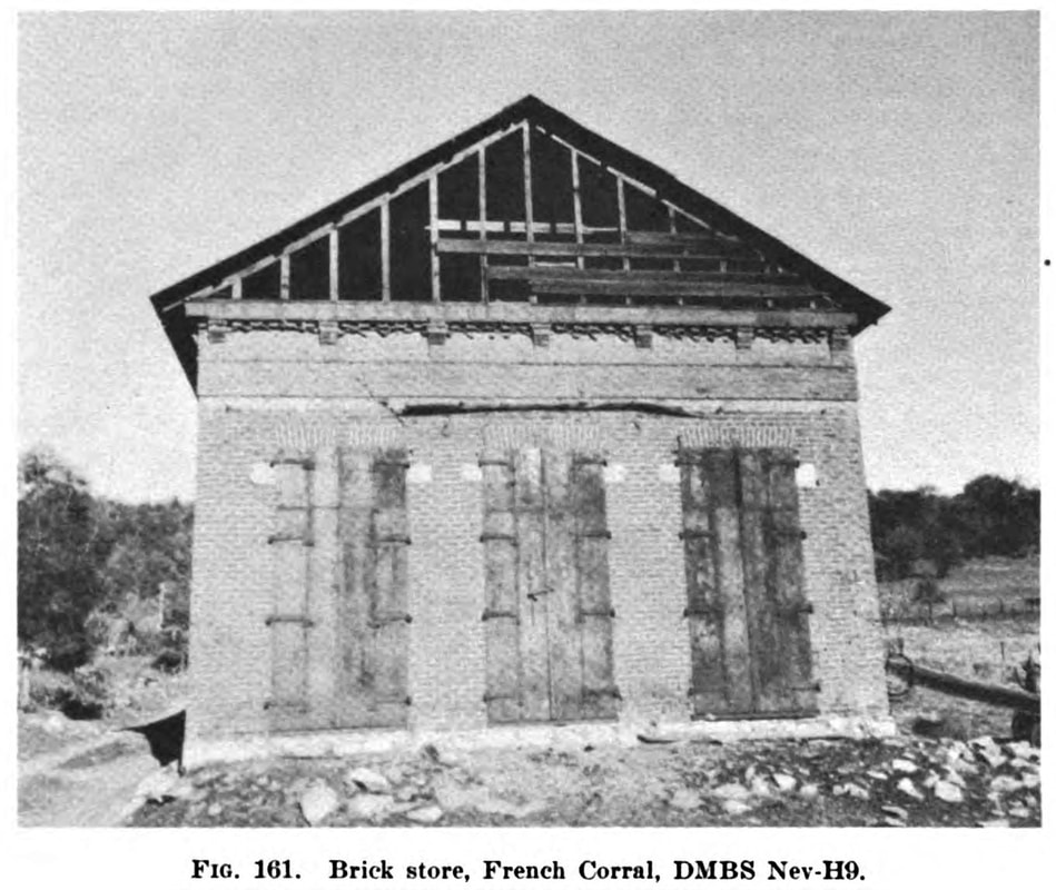 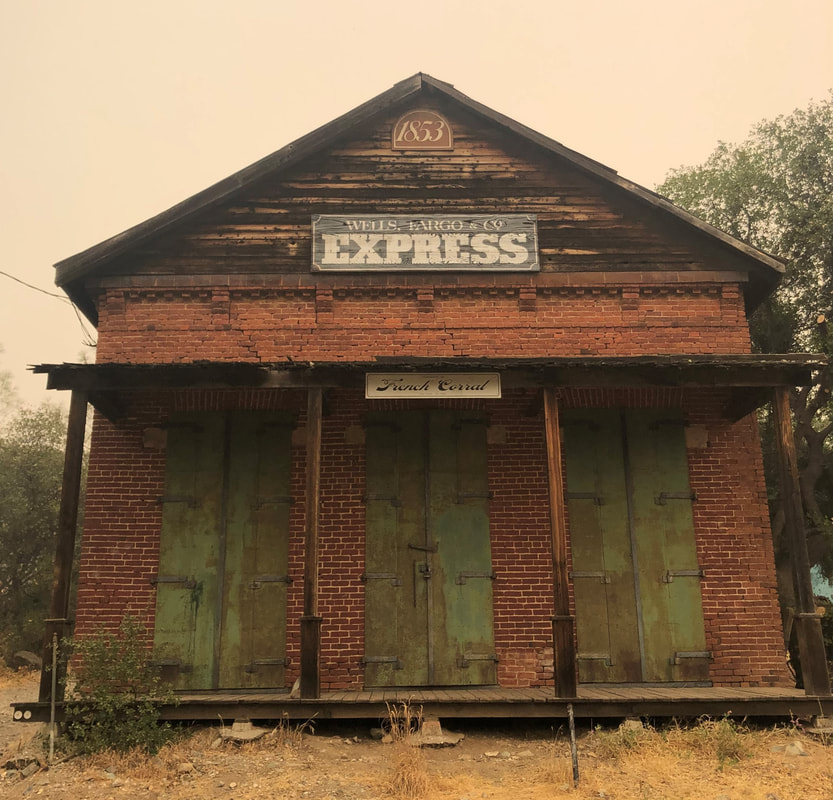 French Corral is pretty far off the highway. At least that's how it seems. The guidebook says it was only 4 miles from Highway 49 but it certainly feels farther and more backroads. These are the towns where I wish I wasn't driving our Camry and instead had a jacked up Chevy Silverado with a Trumper flag in the back. I'm pretty sure I'd be invited to take all the photos I wanted, but as it is I'm the flatlander not to trusted. All that said, I love going to these places that require you to work a little harder to find. 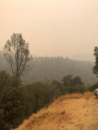 The drive to French Corral though was dominated by one aspect: Smoke. This trip was during the peak of the smoke from the Dixie Fire. Every mile I drove north from Sacramento I saw the air getting worse and worse. Believe me the photo to the right (showing the canyon below French Corral) does not do justice to how bad the visibility was. A better sense of the density of the smoke is in the image below. The famed Bridgeport Covered Bridge is only about 400 feet away. BTW, the covered bridge is worth driving to see, although State Parks is currently rebuilding it. Look close, you can see the workers. 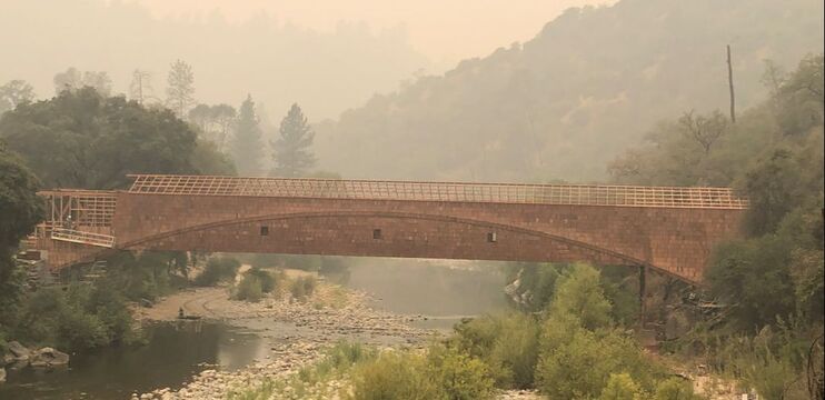 I think that the building visited for this post is an example of one of the problem with these wildfire. In the 75 years since the survey was published that amount and density of vegetation has increased tremendously and dangerously. If you flip through the guidebook, and look for it, you'll soon realize how many formerly open spaces have filled in with oaks, pines, and shrubs. The volume of flammable material is so dense at this point that it is little wonder that these fires take off so quickly. Take a look at the before and after photos above, you'll begin to see it. 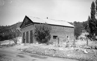 This photo of the building was taken a few years before the 1948 survey, but it give a much better example of how much more open land there was 70 or 80 years ago, let alone 170 years ago. Our wildlands are probably now much better described as wildfirelands. A somewhat similar view (below) of the same building was taken from my car as I was leaving French Corral. The other shows more growth along the north side of the brick building. As these fires burn through the foothills and Sierra Nevada, I wonder if I should just take the time now to try to visit and photograph the old buildings. Part of the reason that people turned to brick and stone buildings was because they could withstand fire, but it seems likely that the damage of these ultra hot wildfires may cause more damage than they could not recovery from.
|
AuthorMy name is Jeff and I am on a hunt to find historic brick and stone structures along Highway 49. Archives
January 2022
Categories
All
|
 RSS Feed
