|
|
Visit Dates: May 31, 2021 & August 15, 2021
This post is a week late. Sorry. Please excuse the work in progress. Here is the thing. I just can't figure out if these two buildings still exists, where they were located, or when/if they might have been destroyed. Figuring out these details is absolutely locking me up. Maybe if we didn't have Covid, and if I was retired, and if I had time to visit the State Library and El Dorado County Archives, then maybe I could feel like I've exhausted all my resources. As it is here is my best attempt to document the sad story of these two buildings located just west of Shingle Springs in El Dorado County.
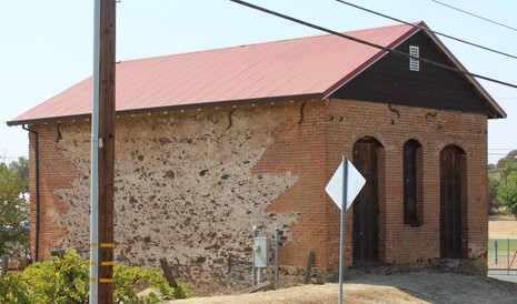
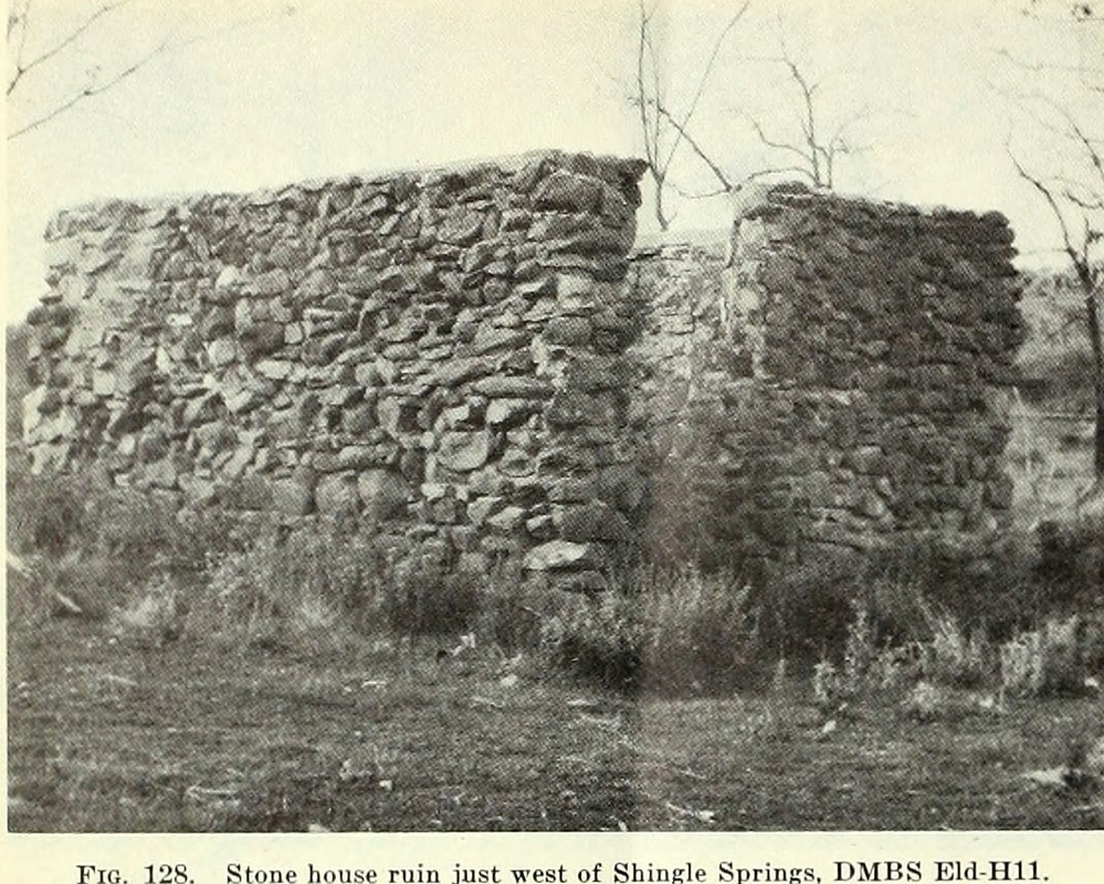
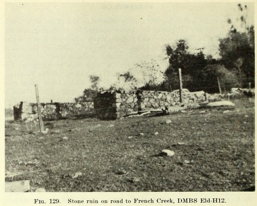
This post is a double double dip. First, it's part one of a two-part discussion. Also its about not one but two sites from the 1948 Division of Mines building survey, although their story and my research are so similar that I've chosen to combine them. The first building (Fig. 128) was described in the survey as "Just west of town near the railroad crossing, a well preserved house of meta-andesite fieldstone, talc schist, and white quartz float laid with mud-lime mortar can be seen." While the second structure (Fig. 129) was south of there, just "a few hundred yards on the French Creek road are two old building ruins made of meta-andesite and serpentine." So there were a few clues to the location: west of Shingle Springs, near the railroad crossings (Fig. 128), and a few hundred yards south on the French Creek Road (Fig. 129). So let's take a look at what that looks like today.
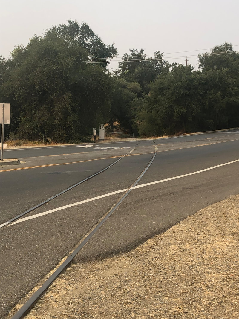
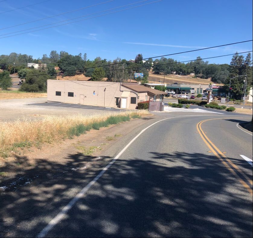
In the map above, the railroad crosses the old highway roughly at the "M" in Mother Lode Drive. Fig. 129 was probably located somewhat near that vicinity. My google map search, drive-by windshield survey, and field work on the ground recon (I walked around) on both sides of the road, though left me still searching for Fig. 128. A similar search along French Creek Road revealed nothing as well. Fig. 129 was probably somewhat near the words "French Creek Road," which is about 600 feet south of the intersection with Mother Lode Road.
So where are these buildings? Sadly, I feel comfortable in saying that they have not survived the nearly 75 years since the Division of Mines building survey. It's likely that their deteriorating condition as seen in the original photos above and the location near the old route of Highway 50 were their downfall.
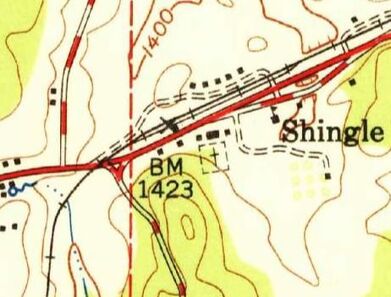 Shingle Springs Quadrant, 7.5 Minute Series, 1950 Shingle Springs Quadrant, 7.5 Minute Series, 1950
In the late 1940s and early 1950s the US Geological Survey released many of their 7.5 minute series maps for the Gold Rush Country. These maps are really really helpful in determining what might have been on the ground at that time, including existing buildings and the routes of the roads and highways at that time. At left is the 1950 Shingle Springs map. French Creek Road is the line running south below (BM 1423), while the railroad crossing is shown to the left of BM 1423. The map shows no showing buildings in the places you would expect our buildings to be based on their description. Note: the road running east-west through Shingle Springs was Highway 50, which is now routed about 200 yards north of the Mother Lode Road (Old Highway 50).

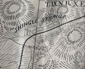
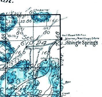
A less detailed map than the one above was a Placerville plat originally drawn in 1893 and updated in 1947 by the USGS. This map does suggest that possibly one of our buildings was on the southwest corner of French Creek Road and the Mother Lode Road. Mother Lode Road was known as the Sacramento and Placerville Road at the time the map was drawn. The scale of this map was such that it is difficult to know if the shown building is merely a representation of Shingle Springs or the location of an actual building, let alone one of our buildings.
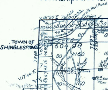
The 1950 map above shows a dotted line running north-south close to our area of interest. This line is the General Land Office survey line between section 1, Range 9 East, Township 9 North and Section 6, Range 10 East, Township 9 North, Mount Diablo Meridian. The surveys of these lines were done in the 1850s and 1860s, and I hoped the plats would possibly show either of our buildings due to the date of buildings and location of the survey.
It was lucky that the surveys went directly through Shingle Springs, but you can see that neither of the plats show any structures to the west of town. The plat on the left would have been the one most likely to have shown one of the buildings. All hope though was not lost. The surveyors also include field notes for their land survey. Maybe they would mention some features not shown on the map. The field notes for section 1, T9N, R9E held the most hope.
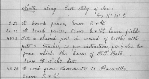
Surveyor David Douglass's notes from his March 1859 survey provide one of the few potential details of one of our buildings that I could find. On page 27 of his field book, Douglass noted features he came across as he moved north along the line between Townships 9 and 10. At 5.50 chains north of corner between sections 1 and 2, he found "A board fence" running east-west, and at 27 chains he crossed a similar fence, but at 40.00 chains he put a charred post in the ground for a quarter section corner, "from which the house of B.T. Hall, bears W(est) 10 ch(ain)s dist(ance)." And then at 40.25 chains he came upon "A road from Sacramento to Placerville, Course E.&W." (A chain length is 66 feet.) So according to the surveyor there was a house south of Shingle Springs and about 650 feet to the west that existed in 1859. I wish there were more details about B.T. Hall's house, which could easily have been building in Fig. 128. (Yes, I know. I know. It is a long shot, but conformation bias is my religion.)
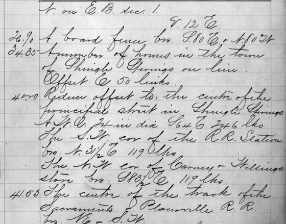
A similar survey was run in the spring of 1865 by James Freeman. Freeman also headed north along the same line. At 34.35 chains he found "A number of houses in the town of Shingle Springs on line." At 40.00 chains he reached the center of principal street through Shingle Springs. So roughly 400 feet south of Shingle Springs were a number of houses. I'm going to speculated (hope really) that one of these was the stone building in Fig. 129.
So by 1865 the railroad ran through Placerville. Maybe that was something I could use. The Placerville and Sacramento Valley Railroad was surveyed in 1865 and filed a map of their line with the Secretary of State in 1867. The map has a lot of detail, just not any of the ones that I needed. While it shows the town of Shingle Springs, even its streets; there were no buildings found along their alignment. Like Gob says, "Come On!"
Okay, let's not give up on the railroad angle. In 1911 the state Railroad Commission required all the railroads in the state to submit alignments and profiles of their lines, as well as the plats of their stations. No doubt this would have the information needed to identify at least one of these buildings, in particular Fig. 128, which was near the railroad crossing. So let's take a look.
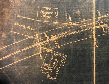
By 1911, the Southern Pacific Railroad had purchased the line. But when it came time to submit the station plat the only one on hand was a blueprint from 1898. Unfortunately our buildings were not close enough or significant to to show up on the plat, although they did draw a few structures near the railroad-county road crossing.
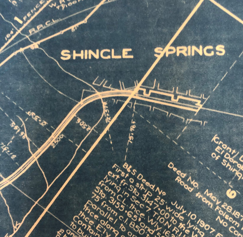
The alignment of the entire line would also have to show the area west of Shingle Springs. So there was a chance we might be a glimpse of the buildings, or may have a good clue. These buildings though are elusive, so guess what. The map furthered my frustrating search as you can see in this map below. Lots of detail about deeded lands but not about structures sitting near railroad line. No wonder no one liked the SPRR.
In the next post we'll conclude with a dive into the highway construction and alignment and how a different routing might have saved 2 old stone buildings.
1 Comment
Sebastian Nelson
8/30/2021 06:27:37 pm
Foothill Beer Temple?! Leave a Reply. |
AuthorMy name is Jeff and I am on a hunt to find historic brick and stone structures along Highway 49. Archives
January 2022
Categories
All
|
 RSS Feed
