|
|
Visit Dates: May 31, 2021 & August 15, 2021
I hate trying to track down old stone and brick buildings that may or may not still exist. It drives me bonkers trying to figure out if the buildings are still standing, where they might be or where they were located, and when they may have been destroyed. I'll confess that when I can't find the structure I'm never totally confident that I've looking in the right spot. I'm pretty sure that the two buildings in this (and previous) post have been destroyed and have left no trace. Remember in grade school when you had to show your work in math class? Well, this post (and Part I) is my attempt to show my work in trying to locate these buildings and also explain what may have happened to them.
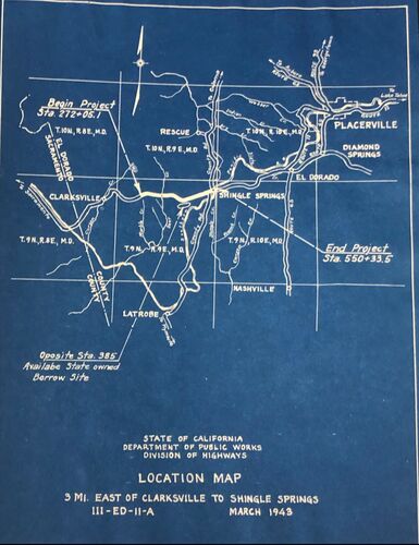
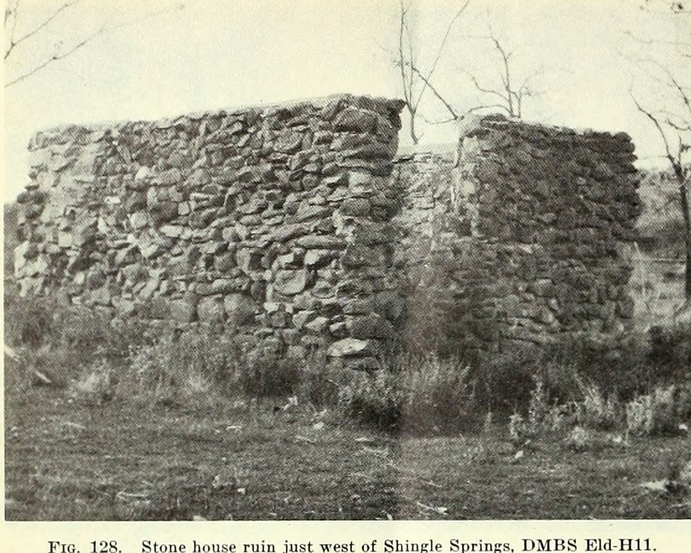
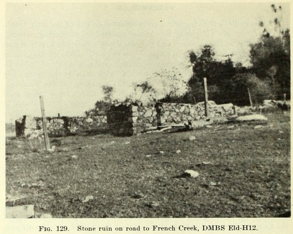
In the previous post we talked trying to find anything we could about the buildings and their possible location. I had searched General Land Office plats, USGS topos, and railroad maps from the 1850s through the 1950s but still found no definitive proof that these building even ever existed. As a reminder the 1948 Division of Mines bulletin described these buildings as being west of Shingle Springs. The first building (Fig. 128) was described as "Just west of town near the railroad crossing, a well preserved house of meta-andesite fieldstone, talc schist, and white quartz float laid with mud-lime mortar can be seen." While the second structure (Fig. 129) was south of there, just "a few hundred yards on the French Creek road are two old building ruins made of meta-andesite and serpentine." The map below is the general location of the site. Note: Lots of modern buildings, not many cool old ones.
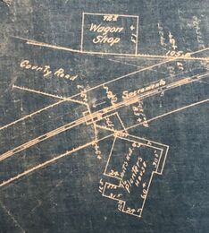
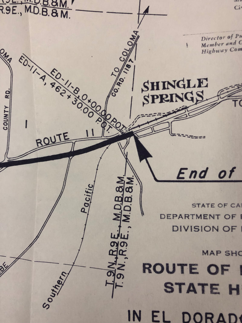
One of the last maps we looked at on the previous blog post was a 1911 map of the Southern Pacific station and rail line near Shingle Springs. As one of the buildings was close to where the railroad crossed the Placerville-Sacramento Road, I though we might find something but like the other maps it was a bust. However the following year, a new entity gave me more hope in documenting at least one of the buildings. See that "County Road" in the SP Station Plat at right? It was about to figure more prominently in the search.
I had hopes that the Highway Commission would provide a clue to the buildings because on November 18, 1912, they directed the Highway Engineer was to "cause the necessary surveys, plans and estimates be made to the portion of Route 11, beginning at Folsom and extending via Clarksville, to Placerville to connect with the State road there." Route 11 was the what would become Highway 50, and guess what it would go right through Shingle Springs on the previous Placerville-Sacramento Road. Probably great news for Shingle Springs but bad news for our buildings.
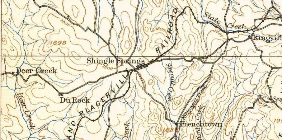
1893 Placerville Topo Map. The Placerville-Sacramento Road is shown running east-west through Shingle Springs.
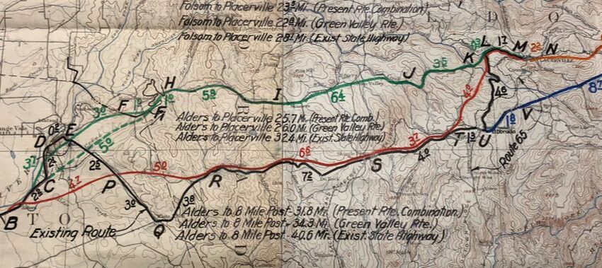
A month before the Highway Commission's vote took place, a preliminary reconnaissance report was submitted to the State Highway Engineer with a recommendation on the best route between Folsom and Placerville. The surveyor located 2 potential routes. The first went by way of Green Valley, which be north of the Placerville-Sacramento Road, and pass through the town of Rescue. This route would be exceedingly hilly necessitating a great deal of bridging but would only be a distance of 24.8 miles. The other route was would leave Folsom, pass through Clarkville, then cross rolling hills to Shingle Springs and El Dorado before crossing the problematic Webber Creek and entering Placerville. The distance was estimated as 26 miles. For the next 30 years, these 2 lines would be contested as the best route between Folsom and Placerville. The surveyor did "not hesitate to recommend the route be way of Clarkville" since it be cheaper to build and accommodate more people and towns. Score one for Shingle Springs, I guess.
With the route selected, the alignment would follow the Sacramento-Placerville Road, which was incorporated into the state highway system. The Division of Highways (today's CalTrans) now began looking to improve the road. In February 1916 another preliminary report was submitted on the route between Shingle Springs and the Sacramento County line. The report came close to giving us some information about Fig. 128, the railroad crossing building. Near the crossing, the report noted that there was an obstruction but that was the old Planters Hotel not our building. Still looking for a clue as the site of this building.
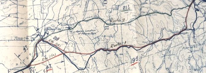
Those people in Rescue though would not give up on having the route altered to travel through their part of the county. They again agitated for a new routing through Green Valley as it would be shorter and more scenic. The Division of Highway noticed their efforts because a few years later a new survey of Route 11 was undertaken by the Division. A 1932 report on finding a permanent route from Sacramento to Placerville included the map above, with a strong nudge towards Route 2 which would bypass Shingle Springs. This came after a 1930 recon report that also noted that the most feasible route would be through Green Valley since it was shorter and had a better alignment. So close to moving the road north, however the original route persisted.
A follow-up report was completed in 1938 with additional information about traffic (it was really increasing) and economics (it costs a lot to build an entirely new road). They finally settled on the upgrading the existing route. In the map below, they recommended the E P R S T L M alignment.
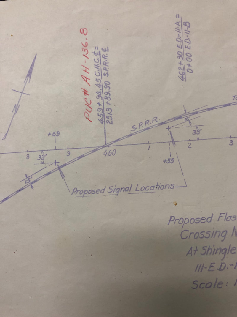
Okay, why is this all important? What's the big deal with the Green Valley route? Why do I care that the Division of Highway's didn't change the route despite plenty of instances to do so. Because if they had re-routed Highway 50 to the Green Valley alignment, then one, if not both, of the buildings may have been saved. By keeping the highway going through Shingle Springs and the Division of Highways and CalTrans continued to try to improve it though re-aligns and relocations. I think that at some point this lead directly or indirectly to the destruction of the building(s). Don't believe me. Take a look at these sketches of proposed re-alignments from the 1940s and 1950s. At some point these buildings didn't stand a chance. In particular the image below left was from a proposed 1953 relocation of the highway. Lots of road work right through the area of our concern. I believe that at the latest the end came in the early 1960s when the highway was moved to it present location a few hundred feet north of the old highway through Shingle Springs.
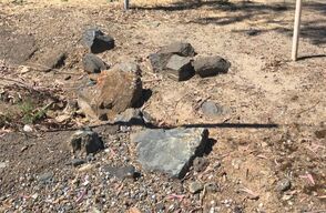
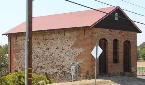
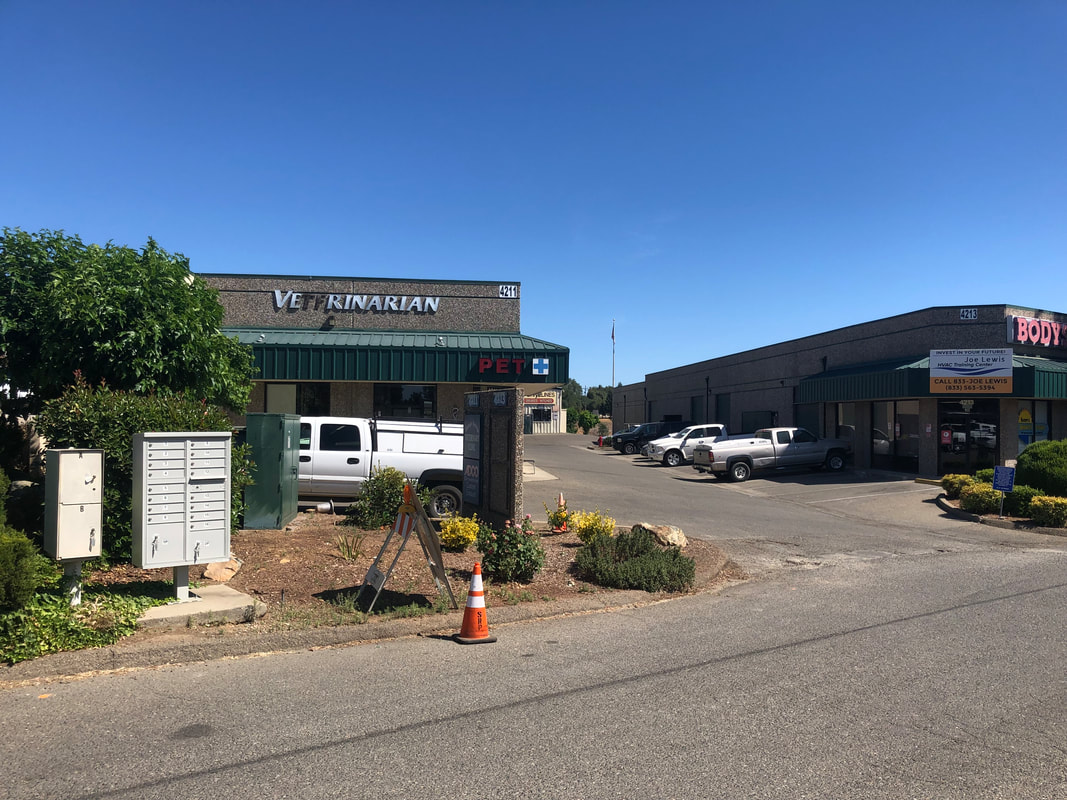
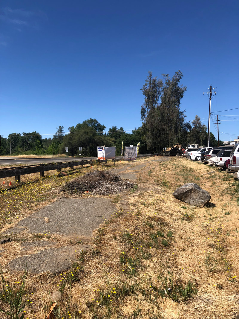
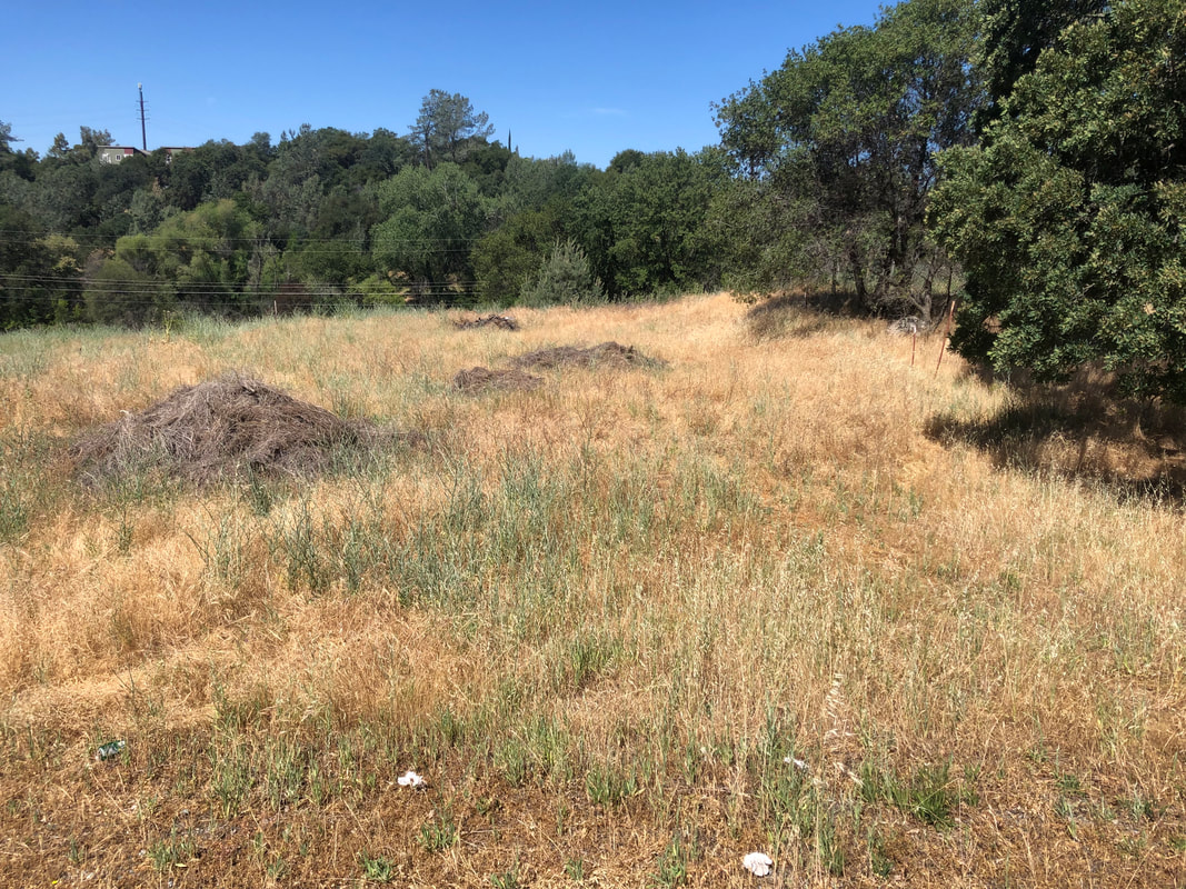
So how did I do, teach? Does my work check out? I wish there was a better answer to my questions about these buildings. As always at least I got to make a nice drive to the foothills for this project. The best I was able to do on one of visits was to get a picture of these rocks near the railroad crossing and the old highway. Maybe they could have been from one of the buildings? Maybe? So what sits at the site today. Check out these photos below.
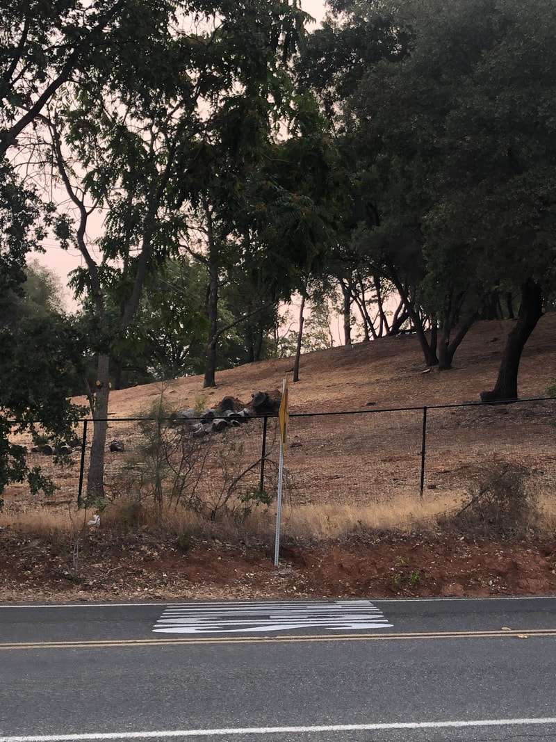
And how about a "few hundred feet (south) on French Town road"? Definitely not an old stone buildings.
1 Comment
Barbara
1/17/2022 05:30:59 pm
I grew up in Shingle Springs 1969 thru 1983. I remember the stone building, in town right on what is now Mother Lode Dr . Leave a Reply. |
AuthorMy name is Jeff and I am on a hunt to find historic brick and stone structures along Highway 49. Archives
January 2022
Categories
All
|
 RSS Feed
